
Surviving 2,583 days at 4874 feet Beneath the Ocean’s Surface on an Active Volcano
The Regional Cabled Array, ROV Jason and R/V Thomas G. Thompson ship crew have had a very busy start to Leg 2
The Regional Cabled Array, ROV Jason and R/V Thomas G. Thompson ship crew have had a very busy start to Leg 2

It has been a very busy few days onboard the R/V Thompson. Since leaving port just only one week ago, the RCA

The InteractiveOceans Data Portal is an interface designed to enable scientists, educators, and students to quickly locate and plot cabled, real-time Ocean
About VISIONS 2018 The Regional Cabled Array annual maintenance cruise took place June 19-August 5, 2018 onboard the global class research ship the R/V Revelle utilizing

VISIONS Sea-Going Research and Discovery For two decades, the University of Washington has been actively engaging students in the at-sea experiential learning
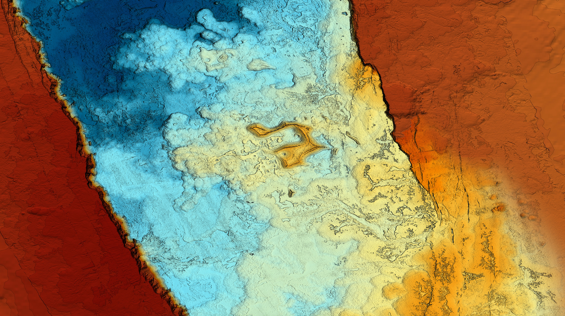
Axial Seamount, on the Juan de Fuca spreading center, is an optimal site for a long-term observatory. It is located just one day by ship from the Washington and Oregon coasts and it is one of the main experimental sites on the Regional Cabled Array. Axial Seamount was chosen as a key observatory site because it is the largest and most magmatically robust volcano on the spreading center, having erupted in 1998, 2011, and again April 24, 2015. It hosts numerous active hydrothermal fields and abundant sites of diffuse flow. It is the most advanced volcanic observatory in the worlds’ oceans: Over 20 instruments now stream data at the speed of light to shore for a global audience to use.

I am a second year Masters student in the School of Marine and Environmental Affairs and Program on Climate Change at the University of Washington. My research interests are diverse, but my current work involves creating a sensitivity index of p

The remotely operated vehicle (ROV) Jason, operated by Woods Hole Oceanographic Institution, is a robotic vehicle that is used to recover and reinstall (turn) much of the Secondary Infrastructure (e.g., instruments, junction boxes) …