August 21:

Coming to you from Southern Hydrate Ridge again. We deployed a rosette tonight, which is a ring of 24 niskins (containers that capture water!), and a CTD (conductivity, temperature, and density probe). This meant that when it resurfaced, we had samples to collect from each niskin! I enjoyed it a lot, it was cool to be working with water from 10,000 feet deep and above. I was trained during my midnight shift so when it came up again in the afternoon, I helped my peers and got to bring out my camera and snap some pics!
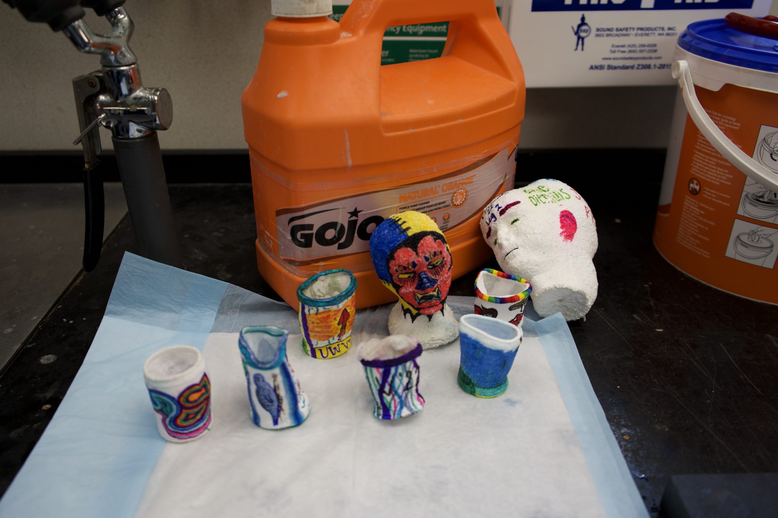
We also sent down some styrofoam cups that we decorated that were shrunk and compressed by the weight of almost 300 atms of pressure.
Later in the afternoon, we saw some Pacific White-Sided dolphins! That was fun, they were playing in the wake of the boat and hanging around us for a bit.

We also saw a sunfish flapping around at the surface! Overall this was a chill day, we have been running ahead of schedule and getting all of our work done! Here are a few photos from earlier on the trip, that I just loaded!
August 19-20:

My day began at midnight. I stepped into the control room and began my shift logging the dive. Using the integrated real-time logging system, I began logging the dive, noting observations such as ship movement, asset collection, biology, and geology observation, and also when samples are collected. This is so going forward, scientists know the longitude and latitude, as well as the surrounding conditions where an event is taking place.
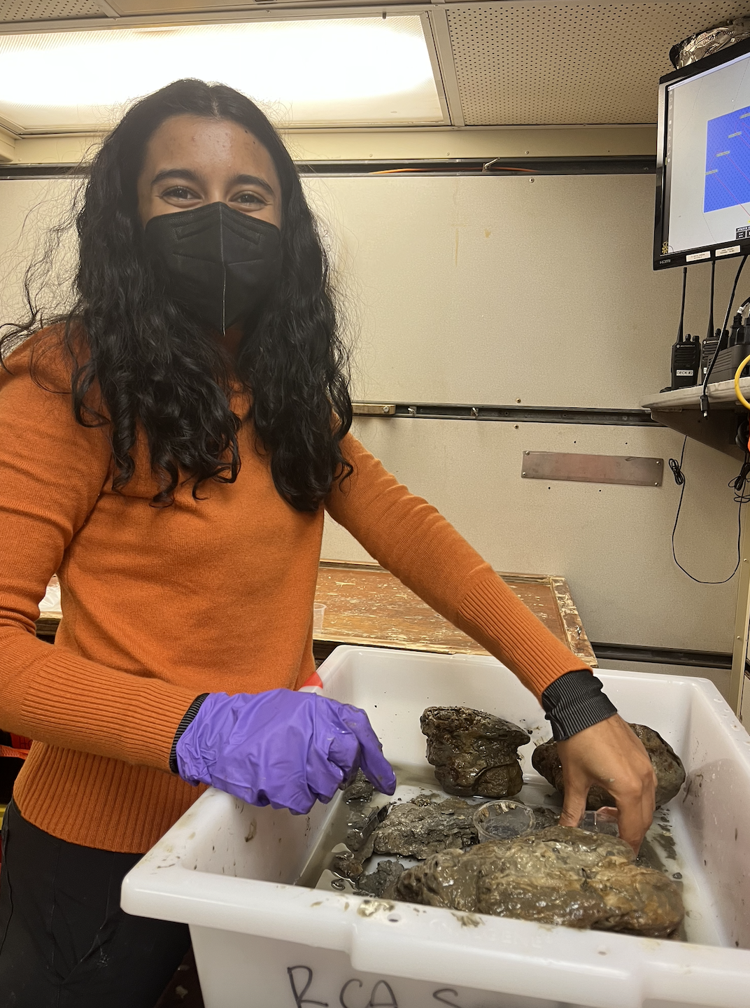
At 01:35 our 1st dive was completed, and after ROPOS was back on deck, we began sampling the niskins. Niskins collects water at any specific depth you tell them to fire. They are crucial to studying oxygen, dissolved inorganic carbon, chlorophyll, and salinity. Julie walked us through how to sample these as I took notes.
By 03:13, after a needed late night snack (dinner was at 17:30 the previous day!), dive 2 began. They attach “lemons” onto the tether that is attached to ROPOS, which are essentially large buoyancy helpers, forming a cantilever, preventing straight line tension on the fiber optic cable. ROPOS stays on the port side of the ship, so as not to get the tether stuck underneath somewhere on the boat.
At 03:58 we reached the bottom, and began the cable work work that needed to be completed. This site was the Oregon Shelf. And just like that, the clock struck 4 and it was time for bed.
At 10:40 in the morning, I woke up at the offshore site. It was a very beautiful day, with high clouds and some sunlight. I grabbed a banana and sat on the bow to look for some whales. Just as I thought that, I saw some humpbacks feeding!
My shift began again, this time we were diving to 580 m depth. It feels surreal to know that this is THE epitome of deep sea work.
We arrived at the Southern Hydrate Ridge!! The samples I wanted to take were on the dive plan 🙂
Southern Hydrate Ridge has a feature called Einstein’s Grotto, and our first task was to run multibeam sonar from the ship and track where active areas of methane plumes were. We found large plumes at the center, as expected.
We dove at 22:30, and here I saw a biodiversity of life. The species list I have noted included rockfish, crabs, eel pouts, scale worms, anemones, lancets, sea stars, snails, bacterial mats, hermit crab, brittle star. We collected rock samples, and after they were on shore I found 2 scale worms, 2 scallops, a sea star, and 2 limpets on it. I scraped off sediment for collection of stored organisms in preserving ethanol. We then prepared an instrument called a CAT, by adding some electrical tape to make it look like a cat 🙂 Image attached!
And just like that, it’s day 4. Yeah, all that happened in ONE day, it is very action packed on here. But I am truly enjoying it, there are no little things to worry about except the very work that is in front of you. With the night shift, it’s hard to keep track of what happened on which day, how much dramamine I’ve taken, and which day it even is!
My midnight shift began with a dive already underway. They were checking out an overview sonar that scans for methane bubbles, but somehow kept getting stuck and was unable to spin 360 degrees. It was interesting because we were relying on a team in Germany to fire off the sonar, so we ended up waiting around a lot due to the lag in the livestream.
The dive went to 771 m depth, with the oxygen levels at 0.17ml/l. They decided to leave the sonar as is, as no clear indications showed why it could not spin. We moved around to locate some bubbling which was my favorite part. We saw fresh hydrate-encased bubbles to feed the surrounding microbe communities. We roamed around towards Smoky Cavern and checked out some more bubbling. There were places that were marked in 2015, and were now dormant.
We got an engine room tour, and saw all 4 engines, 16 cylinders each. That was very cool! And also very loud.
August 17-18:
It has officially marked 24 hours of being on the Thompson! I have answered many of the questions I had before boarding… but not to worry, I have many more.
On Day 2, I woke up at 0700, ate a lovely breakfast and got back to work on my project proposal. I spent a good majority of yesterday talking to different scientists and crew members about their work and following what was beginning to interest me. I looked into all three of our research sites, Oregon Shelf, Southern Hydrate Ridge, and Oregon Slope Base.
Oregon Shelf is our first dive site, most shallow at about 80 m, and also the most shallow OOI site to have cabled items (OOI is: Ocean Observatories Initiative, NSF-funded observatory project). This spot has water influenced by runoff from the Columbia River, as well as cold nutrient-rich water coming up from the deep sea, known as upwelling. It is speculated to have the least visibility of all of our sites.
Southern Hydrate Ridge caught my attention. At this location, there is a lively ecosystem, despite being 780 m deep. The reason being massive methane seeps! Benthic bacterial colonies use the methane as energy, forming the foundation of the ecosystem as food for smaller organisms, which serve as food for larger ones, etc.
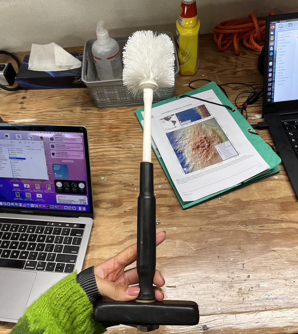
I talked to German scientist Eberhard from the University of Bremen, a physicist leading the maintenance of four cabled sensors funded by Germany at this site, and also a methane expert to learn more. He walked me through the Bremen goals at this site, which is to replace a CTD sensor, clean the overview sonar (it cannot spin its full 360 degrees currently), and move the digital camera. He mounted a toilet brush onto a T grip for the ROV to use, image attached!
His team is mapping the frequency of methane bubble releases. The sonar pings upwards and outwards, and the acoustic waves bounce off the methane bubbles when they are present. These are some of the questions I had for him:
Do we have instruments/probes that can measure methane?
→ This is a challenging process, because as soon after methane is released, the diffusely flowing fluids become diluted into the ocean rapidly. Technology to capture the methane struggles as well, because methane hydrate soon forms in instruments to capture the fluids, clogging the instruments and making it difficult to continue sampling.
Can we measure the bacterial mats using mass spectrometry or the current instruments?
→ We would need a downward facing camera, currently some mats can be seen but not many are in view, as this has not been a focus. Mass spectrometry could be interesting to try and the OOI has had a cabled instrument at this site in the past.
What else is there to learn from methane releases besides the frequency of the plumes at focused sites?
→ When it was produced! In subduction zones and how old it is, etc
Does methane reach the atmosphere here and is it a concern?
→ No, since this is so deep, the methane has a long way to travel to the surface. It is almost entirely consumed by microbes that utilize the gas.
After our conversation, I still had some more thinking to do…

Later we had some safety drills, but ALSO, got a tour of ROPOS, the ROV being deployed which was so awesome! We got a look into the control room where we will be on watch (I have the midnight to 4 am shift, and the noon to 4pm shift). It is currently being prepared to be deployed tonight! Around 7pm, if you want to check out the live-stream 😉
Jessica, a ROPOS team member, was adding in the oils that fill the electronic spaces, protecting them from leaks by having a positive pressure in the hold. She was very kind to show me different parts of the ROV while I was sketching it out. My sketch is attached below.
We ate a delicious lunch, some yummy gyros, and then I finalized my project.
I would like to sample some of the benthic bacterial communities from the Southern Hydrate Ridge and conduct PCR to test them for antimicrobial properties. At the very least, I hope to sequence their DNA.