A research expedition starts with a plan. Planning allows everyone to know the goals of the cruise, how much time we will have to complete our tasks, and the route to follow to get to each location. Cruises are expensive and time-limited, so using that time effectively is crucial. But no matter how detailed or intricately scheduled the cruise plan is, there is one huge thing that cannot be fully accounted for: the ocean. Weather fronts, currents moving at different angles than the wind or the surface waves, mysterious swells from far-off events, turbulence that swirls sediment particles into the water, cutting visibility – all of these can derail the most carefully laid plans.
Stubbornly sticking to a plan despite ocean conditions working against you can (at best) waste precious time, and (at worst) be dangerous to the ship and crew. Therefore, flexibility is key, and we try to build contingencies into the cruise plan to allow for science to continue even if the conditions at the planned work site turn for the worse.
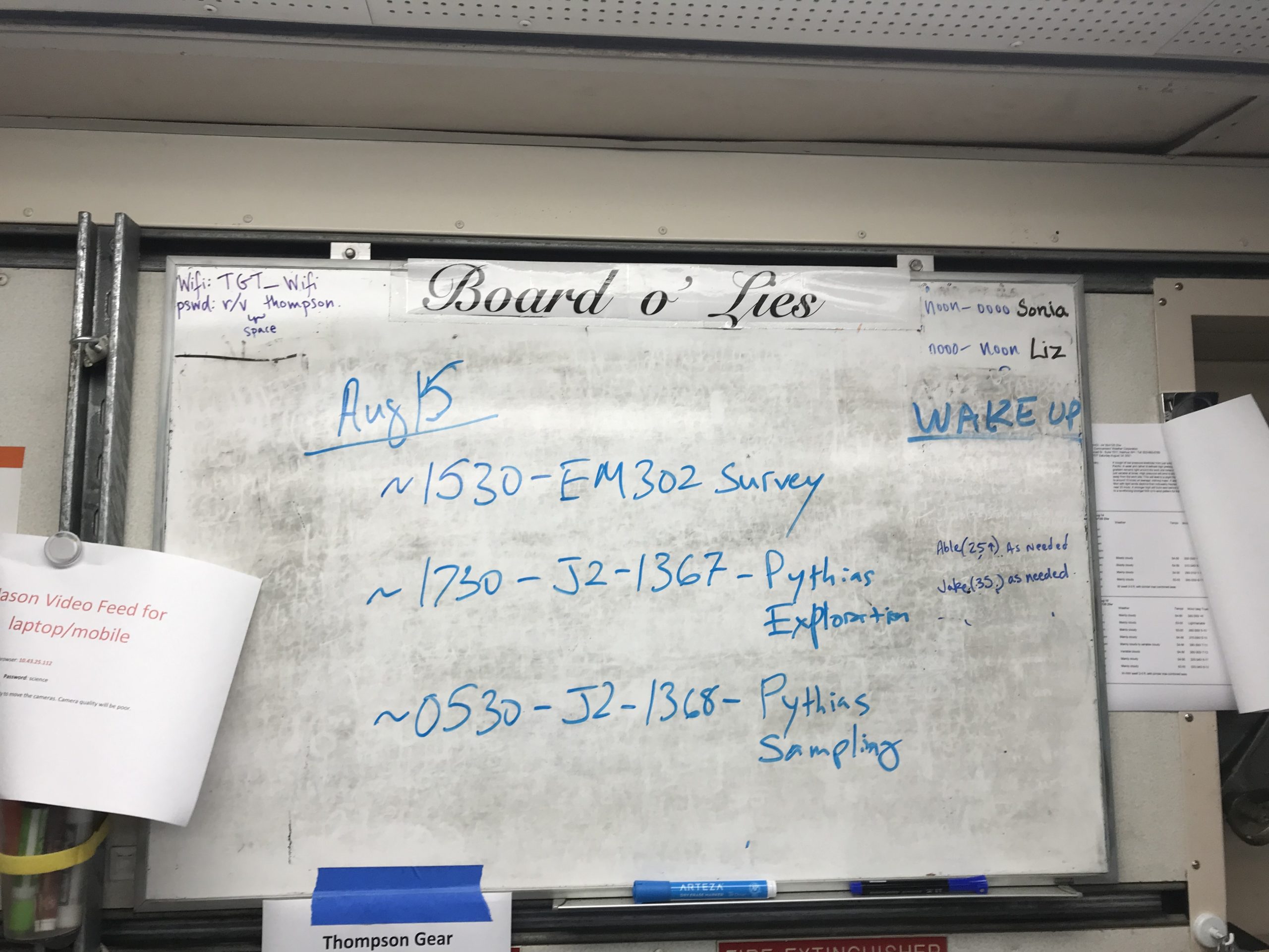
The last few days of the VISIONS’21 cruise have been a study in flexible planning. We had intended to move methodically from site to site, completing our instrument swaps and deployment activities as we went. However, the first dive on August 10th took longer than anticipated due to the complicated nature of the primary node repair activities, involving coordination between the research vessel Thomas G. Thompson, the cable ship Integrity, the ROV Jason, and the UW/APL engineers. That dive was eventually completed successfully, the primary node was recovered by the Integrity, and we could move on with the rest of our plan.
Credit: UW/NSF-OOI/WHOI, V21
We moved to an extremely deep site (Slope Base, 2900 meters) and started the swap of a secondary node (LV01A). But then a large, unexpected swell (a large surface wave produced by far-off storms) began rolling through the area, which would have made it dangerous for Jason to recover with the heavy node latched beneath it. The tether that connects Jason to the ship and delivers power and communication (which is what allows the pilots to fly the ROV from a control room on the ship) is rated for very heavy loads, but an unanticipated wave can create a sudden tug on the tether that is higher than it can sustain or create a twist in the wire that would have to be repaired on the ship. So, we returned the node to the seafloor to recover another time.
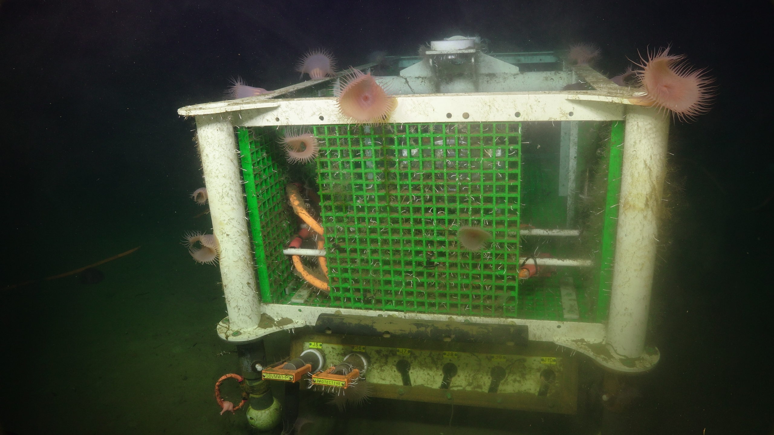
The swell in the area also derailed our plans for the next instrument swap, so we had to come up with an alternate plan. Instead of just waiting on site for the weather to improve, we conducted multibeam sonar surveys of the area. These surveys provide seafloor bathymetry information and can potentially identify the location of plumes of naturally occurring methane bubbles that are released from the seafloor at a location called Southern Hydrate Ridge. Once the sun rose on August 12th we checked the weather again and determined that we could dive in the afternoon. So today we were able to deliver a sonar instrument built by a German team at MARUM to Hydrate Ridge, and then moved to the Oregon Offshore site to deploy a seafloor instrument package and a new digital still camera.
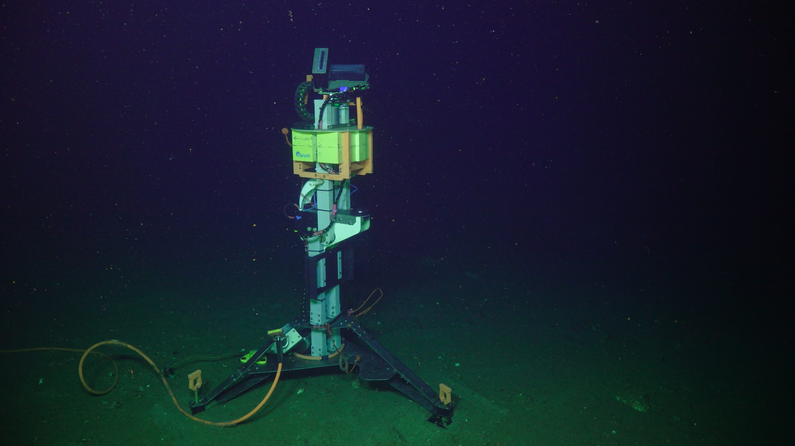
Credit: UW/NSF-OOI/WHOI, V21
Now we are faced with a new decision point, which is again dependent on the weather: we will either head back to Southern Hydrate Ridge or to a shallow location called Oregon Shelf (if the weather looks favorable). We also need to go back to Slope Base at some point to recover the node we left there, but that requires very good conditions due to the weight of the node. Alternately, we could run an exploratory science dive at a site of interest nearby if the weather will not allow us to launch the ROV with any instruments attached. So the plan is basically a blueprint that leads to a series of choices based on cost/benefit assessments and schedule constraints. Shuffling things around on the fly can be stressful, but we’ll remain flexible and attempt to get all of our work done, if ocean conditions allow.