
The end of Leg 2 marked another successful field program for the Regional Cabled Array 2022 expedition: all NSF-Ocean Observatory Initiative (OOI) goals and more were met. The nine VISIONS’22 students witnessed life that thrives along the Cascadia Margin in some of the most biological productive waters in the oceans, the abyssal plain at 2900 m, and highly dynamic methane seeps at Southern Hydrate Ridge hosting amazing macrofaunal, miofaunal, and microbial communities and associated habitats. All OOI infrastructure and instrument turns scheduled for Leg 2 were completed successfully, as well as all PI-funded work.
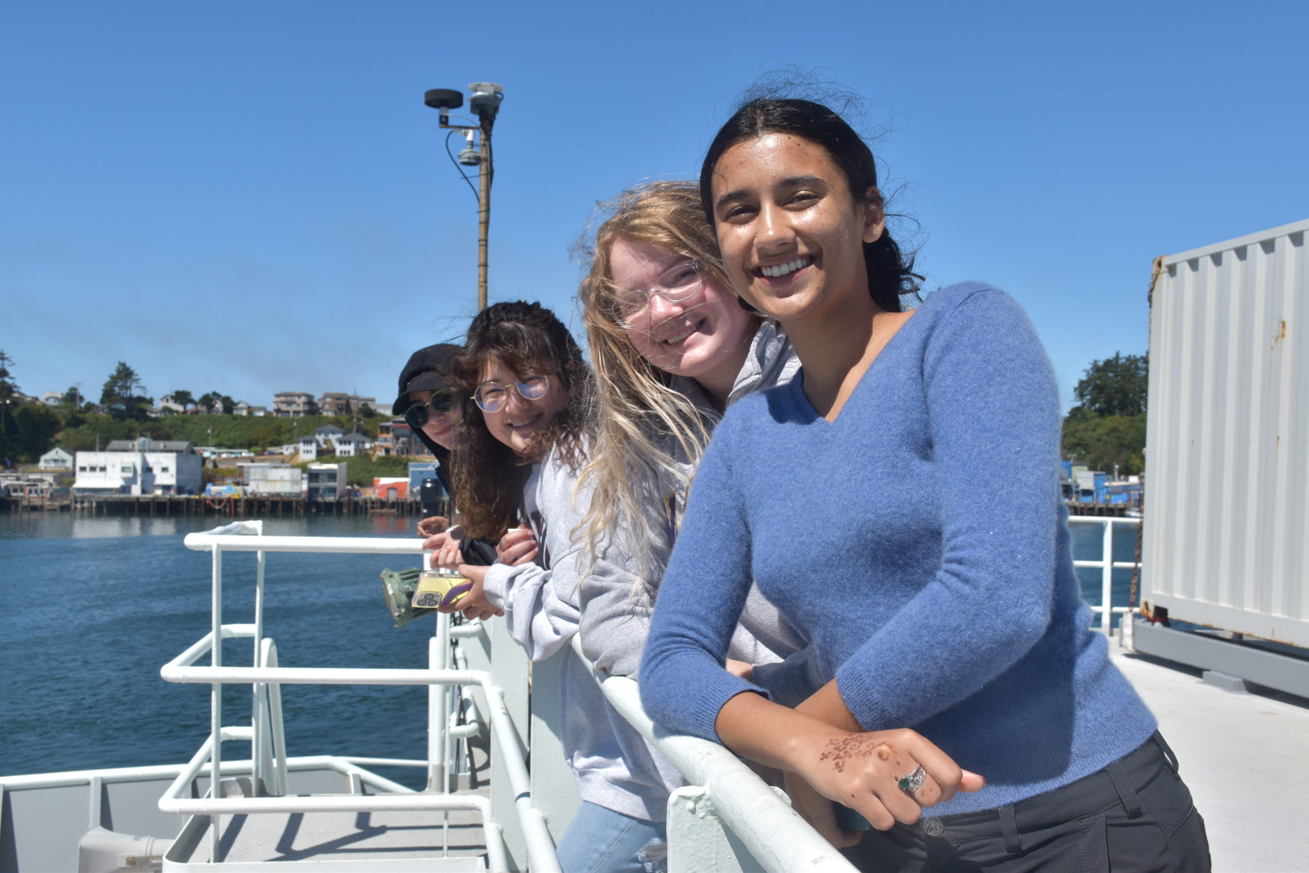
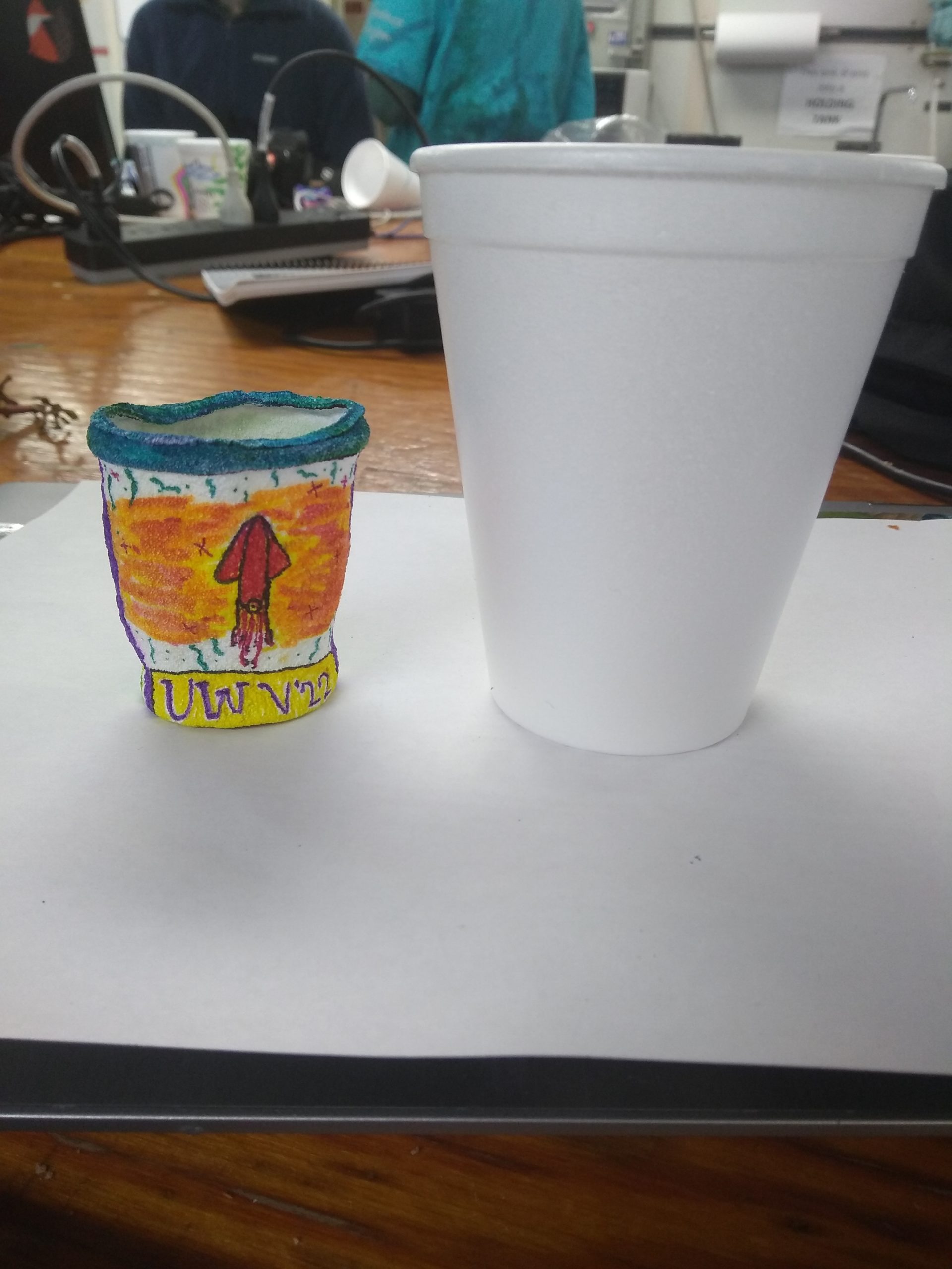
It was an amazingly busy five days at-sea, during which time the ROV ROPOS onboard the R/V Thompson visited the water column and seafloor at the Oregon Shelf,Oregon Offshore, and Southern Hydrate Ridge sites. The students got to conduct their own pressure experiments during a during a deep CTD cast at the Slope Base site (2900 m, 9500 feet beneath the ocean’s surface) shrinking Styrofoam cups and heads – pressure nearly 300 times what we experience on land does some remarkable things.
Once again, the ROV ROPOS was highly successful at its task, completing 11 dives (R2218 – R2228), which included the:
- Recovery and installation (i.e turn) of two Benthic Experiment Packages (BEPs) at the Oregon Shelf and Oregon Slope sites (each of which hosts eight instruments). Deployments went extremely smoothly despite difficult conditions and low visibility at the 80 m water depth Shelf;
- Turn of an Oregon Shelf Bioacoustic Sonar instrument that measures organisms (zooplankton) migration up and down through the water column;
- Turn of the Low-Voltage Node LV01B (small substation) at Southern Hydrate Ridge (SHR);
- Testing and then turning of short period seismometer at SHR that measures local earthquakes in an area believed to be an unlocked portion of the Cascadia Subduction Zone.
- Turn of three uncabled flow meter instruments and a fluid sampler at SHR: These instruments measure the flow of ocean water into the sediments, and seepage of methane-rich fluids out of the seafloor.
- Turn of a cabled CTD (funded by MARUM-University of Bremen, Germany) at SHR.
- Inspection and cleaning of the lights and lenses of four seafloor cameras (the OOI digital still cameras at Oregon Shelf, Oregon Offshore, and Southern Hydrate Ridge and the MARUM 4K camera at Southern Hydrate Ridge) and cleaning of the sonar heads of the two MARUM sonar systems (the quantification sonar and Overview sonar);
- Completion of a phenomenal photomosaic survey of two areas of interest at SHR to document significant changes in the seafloor morphology, methane seep sites, and biological communities that they support in this highly dynamic area. The topography around the OOI instrumentation has changed dramatically since the first photomosaic in 2014 due to methane gas blowouts, gas hydrate dissolution, and sediment slumping following the escape of deep methane Thousands of images will be “stitched” together to produce a rare overview of the seafloor and life;
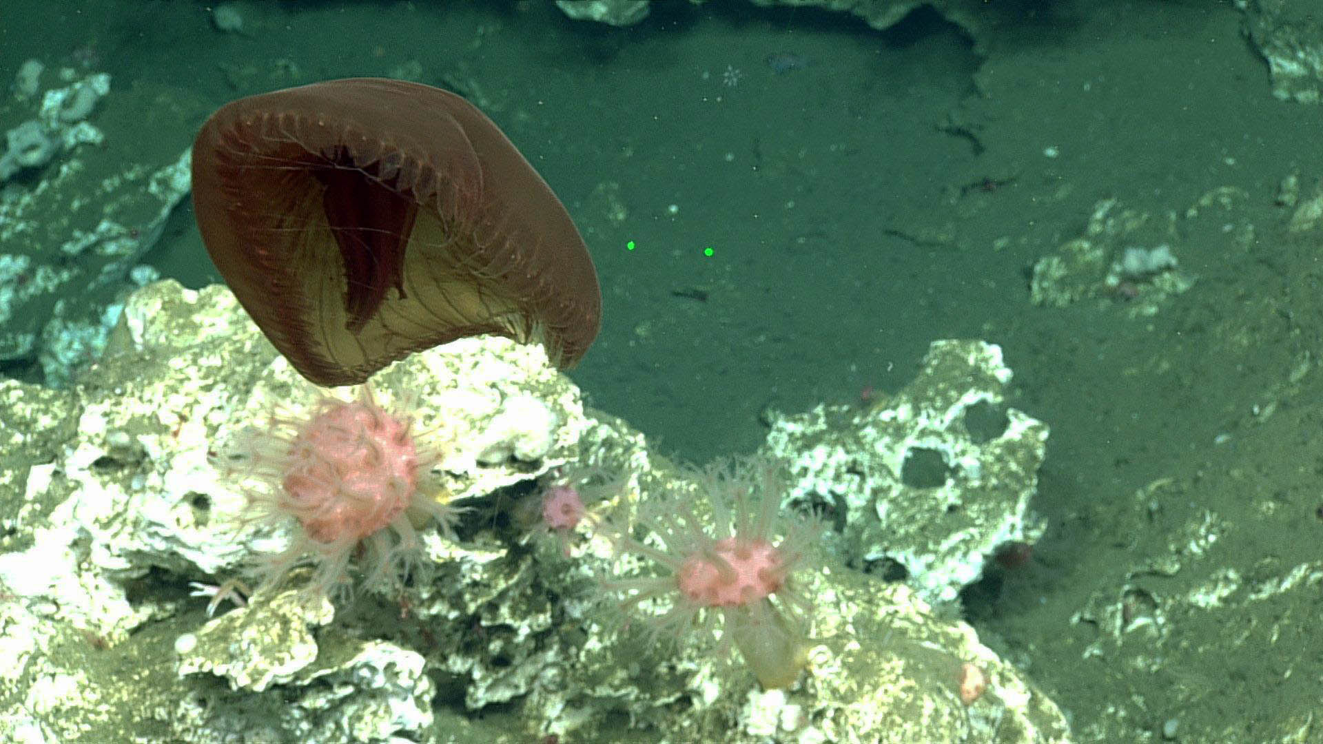
- Fun exploratory dive at the 60 m tall limestone Pinnacle site at SHR to survey the fauna and geographic features of the area, as a comparison to the biodiversity and topography seen at SHR; and
- Collection using ROPOS-mounted Niskin bottles to collect fluids at very close proximity to three of the instrument sites at Shelf BEP, Offshore BEP, and Southern Hydrate Ridge CTD) for follow-on verification of the instrument data.

Finally, the hull-mounted echosounder/multibeam sonar on the R/V Thompson was used to conduct surveys on and around SHR. The multibeam sonar imaged methane bubble plumes rising ~ 400 m above the seafloor. This allows investigation of the changes in active seep locations and in the intensity of bubble emissions, and documentation of new, previously undetected venting sites.
WHEW – a jam packed five days this was.