Axial Seamount is the most magmatically robust volcano on the Juan de Fuca Ridge spreading center. It hosts numerous active hydrothermal fields and abundant sites of diffuse flow.
A variety of geophysical sensors are deployed at the base of Axial Seamount to monitor seismic events on the Juan de Fuca plate.
Cabled Array core infrastructure and instruments at the summit of Axial Seamount. Also shown in yellow are new instruments funded by the National Science Foundation (COVIS sonar,self calibrating pressure sensor, and flipping tilt meter) and an 3D temperature array platform that will be installed this year, followed by the instrument array next year funded by the Office of Navy Reserach. Credit. D. Kelley and CEV, University of Washington.
Location of Cabled Array infrastructure at Axial Base in 2017 and positions of CTD casts. Credit: M. Elend, University of Washington.
Perspective view of Cabled Array infrastructure at the base of Axial Seamount (~2600 m water depth).
The National Science Foundations' Ocean Observatories Initiative Regional Cabled Observatory spans the Juan de Fuca tectonic plate. Two high power and bandwidth submarine fiber optic cables (900 km total in length) link to Axial Seamount and to several margin sites off of Newport Oregon.
A small cluster of blue ciliates intermixed with limpets grow in a diffuse flow site on the the 2011 lava flow at the summit of Axial Seamount. Credit: UW/OOI-NSF/WHOI; J2-980; V17.
A beautiful ropey, jumbled sheet flow covers the seafloor at ~1500 m beneath the oceans' surface at the summit of Axial Seamount. The lava was erupted in April 2011. Credit: UW/OOI-NSF/WHOI; J2-980; V17.
A dense colony of tube worms awash in warm diffusely venting fluids grow on the April 2011 lava flow at the summit of Axial Seamount. UW/OOI-NSF/WHOI; J2-980; V17.
Healthy tube worms grow along a venting fracture in the 2011 glassy lava flow at the summit of Axial Seamount. Credit: UW/OOI-NSF/WHOI; J2-980; V17.
A glass-coated sheet flow sample recovered on Jason Dive J2-980 from the April 2011 lava flow on Axial Seamount. Credit. Mitch Elend, University of Washington, V17.
The R/V Revelle transits under calm seas to Axial Seamount, the largest and most active volcano on the Juan de Fuca Ridge. Credit: Hanis Zulaikha, University of Washington.
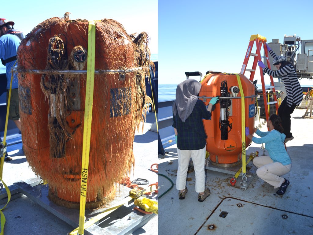
This science pod was cut loose from the Axial Base Shallow Profiler mooring on Sunday morning and was throughly cleaned by an eager group of students. The growth visible on the pod comes after just one year in the water, and since many of the instruments on the pod require unobstructed intake lines for sampling, the pods must be replaced yearly.
Columns in a collapsed area that once hosted a lava lake are reminiscent of an ancient city. Rings mark lowering of the lake as lava drained out. Fossilized drips of lava are preserved hanging from the ceiling. A rattail fish explores the site. This is part of the 2011 eruption at Axial. Credit: UW/OO-NSF/WHOI; J2-980; V17.
During Jason Dive J2-980, the remnants of multiple lava lakes from the April 2011 eruption of Axial Seamount were encountered. The bathtub rings mark the progressive lowering of the "lake". Credit: UW/OOI-NSF/WHOI; J2-980; V17.
Tubeworms with red plumes grow on the side of an odd basalt formation formed as part of a fossilized lava lake at the summit of Axial Seamount in 2011. Depth is ~1500 m. UW/OOI-NSF/WHOI; J2-980; V17.