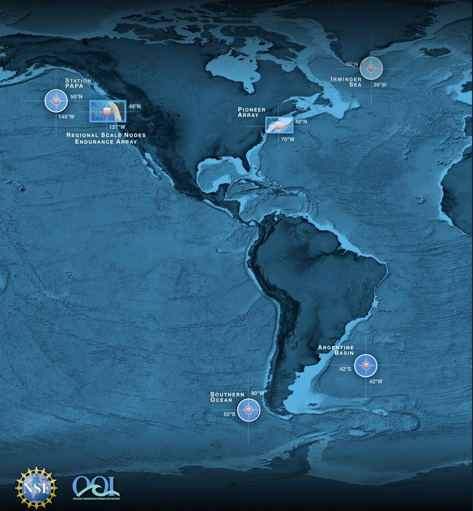
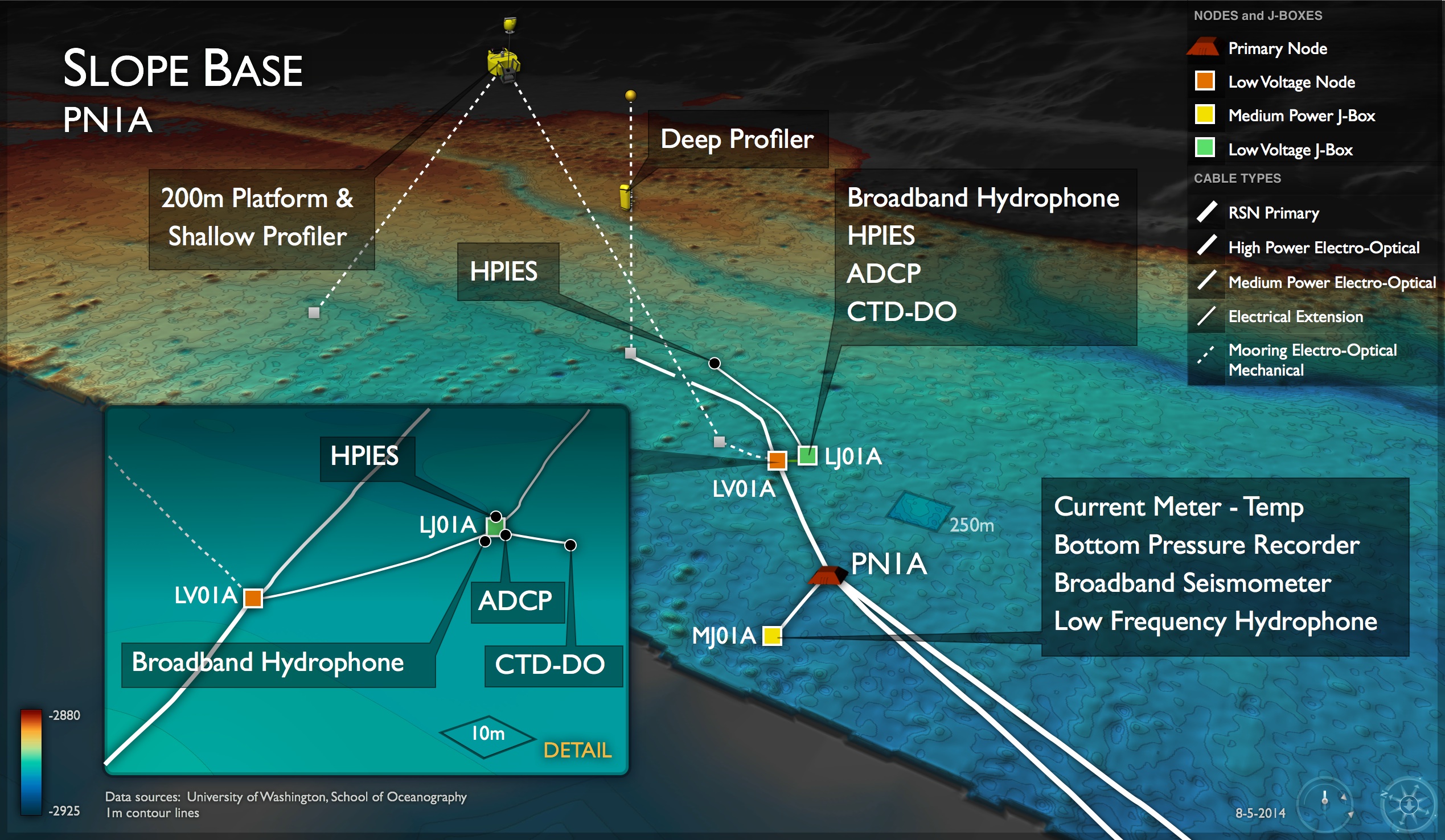
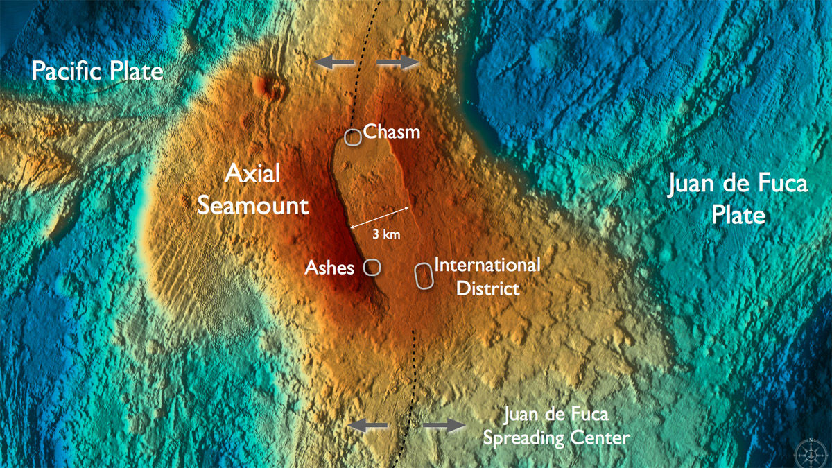
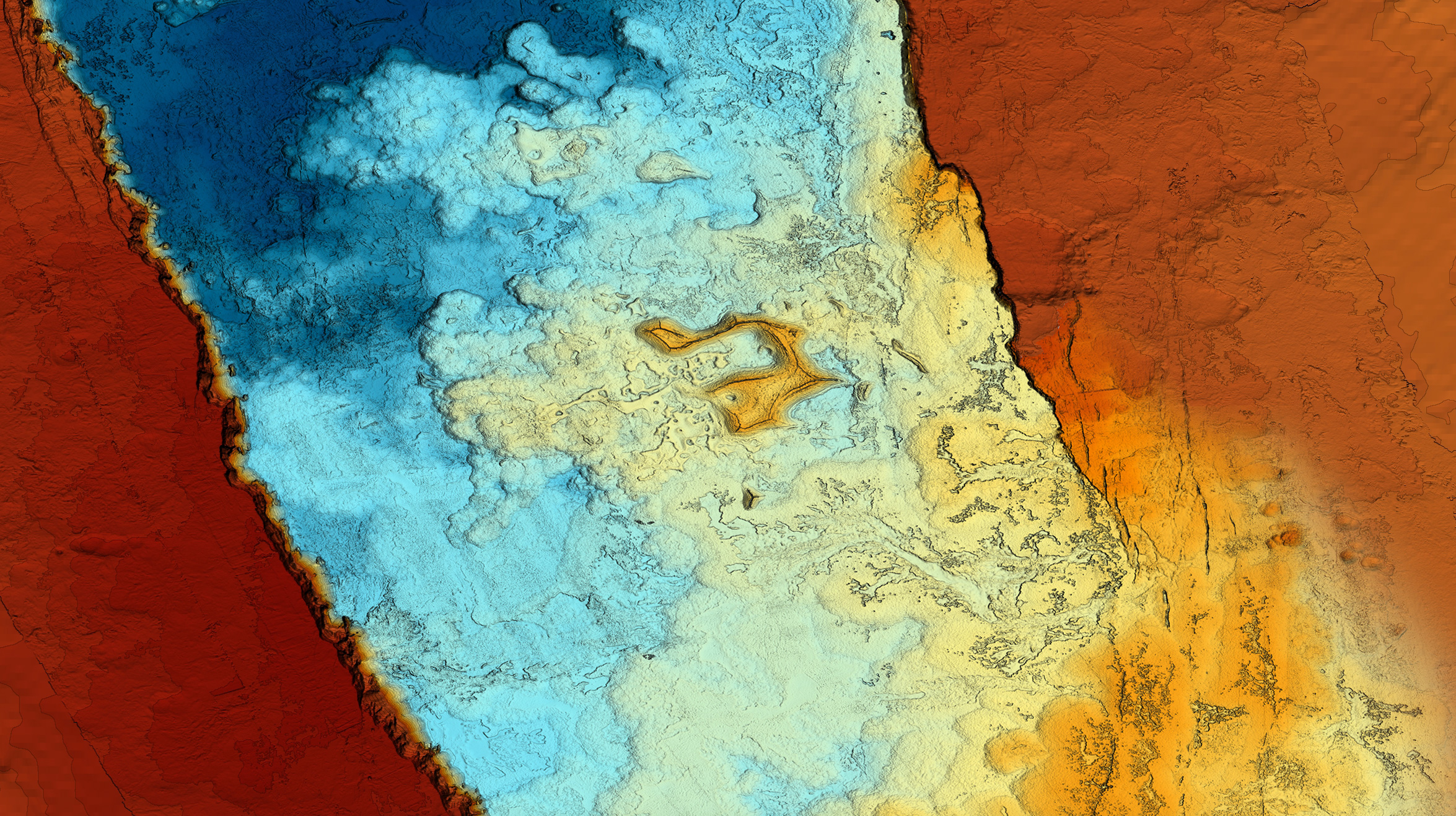
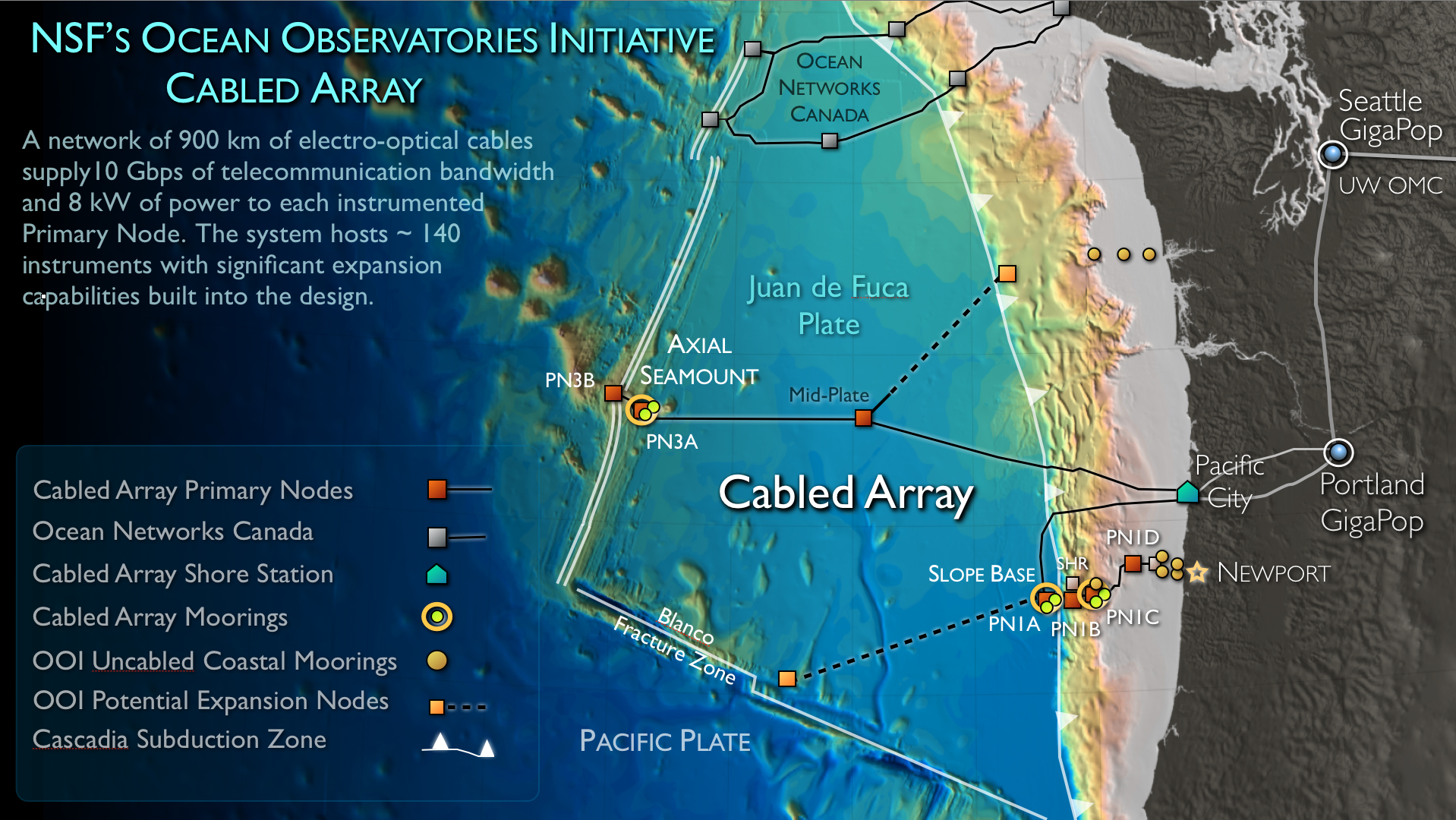
The Slope Base Site is located at PN1A at a depth of ~2900 m. It will host a state-of-the-art instrumented Shallow Profiling Mooring, a Deep Profiling Mooring, and an array of seafloor instruments.
Cabled Array infrastructure at the Oregon Offshore Site as installed in 2017. The site was trawled fall 2017: the Shallow Profiler Mooring (PC01B-SC01B) will be reinstalled during the Cabled Array 2018 field program. Credit: M. Elend, University of Washington.
The Oregon Inshore Site will host both cabled and uncabled infrastructure. During the VISIONS'14 cruise, it is anticipated that a Surface Piercing Profiler system, a Benthic Experiemtal Platform, and associated instruments will be installed.
Cabled infrastructure at the Oregon Endurance Shelf site, in 80 m of water, obtains power and communications from Primary Node PN1D located ~ 17 km to the west. The site is impacted by strong currents with very turbid water due to high productivity. Credit. D. Kelley and CEV, University of Washington.
Cabled Array core infrastructure and instruments at the summit of Axial Seamount. Also shown in yellow are new instruments funded by the National Science Foundation (COVIS sonar,self calibrating pressure sensor, and flipping tilt meter) and an 3D temperature array platform that will be installed this year, followed by the instrument array next year funded by the Office of Navy Reserach. Credit. D. Kelley and CEV, University of Washington.
This platform at 200 m beneath the ocean's surface is on the RSN two-legged mooring. The 12-foot-across platform will host the instrumented Shallow Winched Profiler, as well as an instrument science module on the platform itself (including a digital still camera and ADCP). All data will be streamed in real-time through the seafloor cable and onto the Internet for ingestion and redistribution by the OOI Cyberinfrastructure. (Illustration by Patrick Waite, University of Washington)
Secondary nodes will connect to the primary nodes and transfer power and bandwidth to sensor networks. They are scheduled for deployment in 2013 using an ROV.
--Graphic credit: OOI RSN and Center for Environmental Visualization, University of Washington