

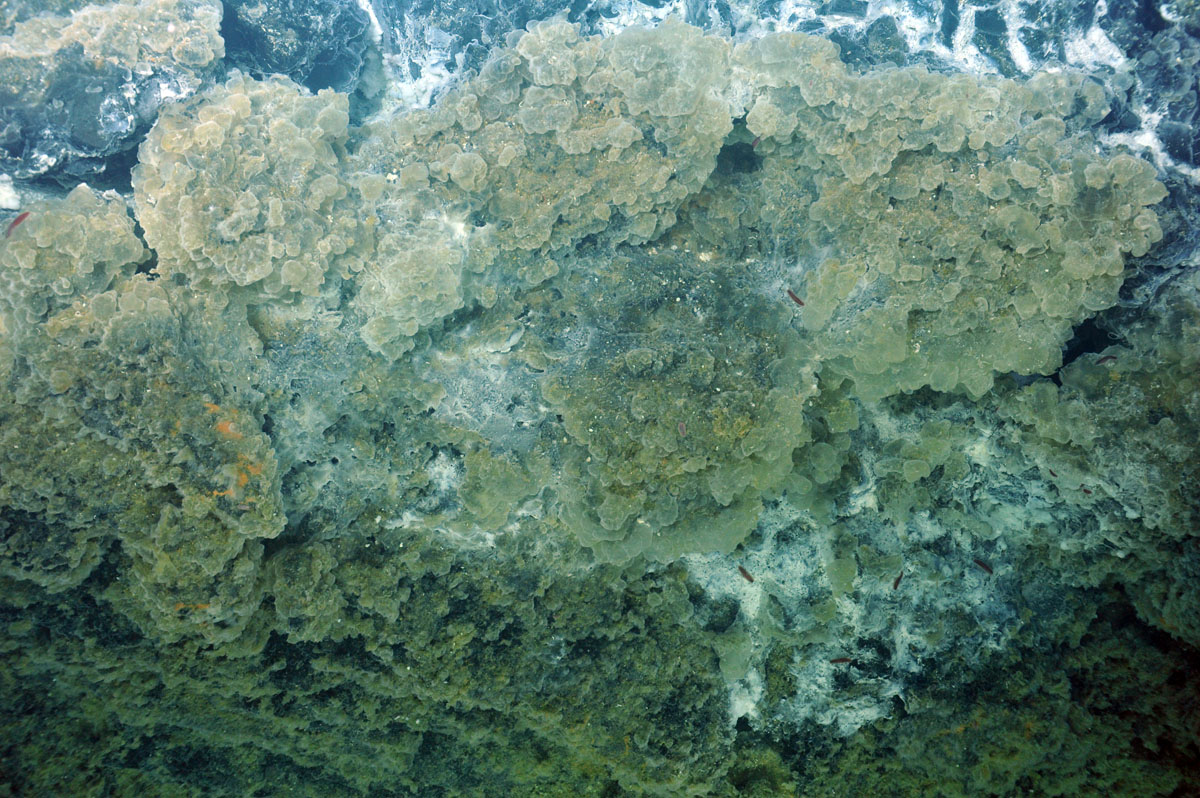


Yesterday and into the early afternoon was a long “day” with a lot of seafloor covered by the ROV in the caldera of Axial Seamount. Allison and Giora ran a pressure experiment on a styrofoam head and cup, imaging it in high definition as the ROV descended to 5000 feet beneath the ocean's surface. We successfully completed imaging of potential instrumentation sites within the International District and two cable paths down to the diffuse flow site known as “Bag City” to the south. Leading the cable route survey to the south, Allison discovered a very large field of beautiful snowblowers – that area is now known as Skadi, the Norse Goddess of Snow. The snowblowers are located on a large pressure ridge of broken flows and bounded by zones of collapse. Billowing clouds of microbial material issue from the vent openings. Much of this material is believed to be extracellular polysaccaride produced in excess by the subsurface microbes following an eruption. It was a spectacular view and not one the science and ROV team will easily forget.
During the wee hours of the morning, we continued an almost one-on-one conversation with our faithful twitter followers. Near Bag City we visited the vents Vixen and Casper previously sampled by Dave Butterfield, NOAA-PMEL, who was part of the team that discovered that the April eruption had taken place. South of Bag City there was an extensive area of extremely thick biological growth, reminiscent of thick mossy beds on the glassy and altered basalts. High-resolution imaging with the high-definition camera showed that this area was similar to Bag City in that the “mossy” areas were composed of gelatinous-looking translucent bags that are clearly biological origin. ROPOS followed a very large southern fissure system down the south flank of the volcano, imaging sites of major lava channels, columns, and collapse basin formed during the recent eruption in April 2011.
Tonight we will do a short dive on the southernmost extent of the April eruption. This area was mapped earlier on this cruise using the R/V Thompson's EM302 hull-mounted bathymetry system. Differencing between bathymetry collected in previous years and that collected during this cruise shows that the thickest (> 20 m) lava flow found thus far from the April eruption is in this area. During the dive we will image the flow and take samples for age dating along the way.
Around midnight we will have our first exploration dive of the hydrothermal field “The Dependable,” which was discovered on an earlier dive in this program.