Image Archive





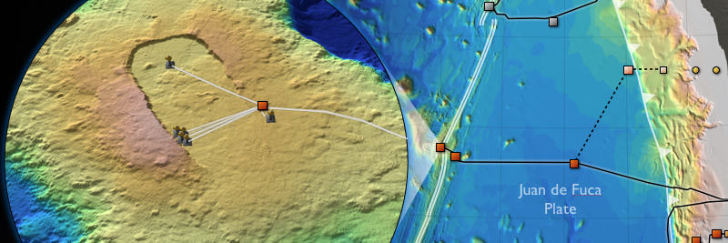




Location of nodes, cables and instruments to be deployed during the VISIONS'13 expedition at, and near, the ASHES Hydrothermal Vent Field.

The cabled geophysical array at the Central Caldera Site is focused on measuring the inflation and deflation of the volcano, earthquakes, and the movement of of molten lava within the core of the volcano. Bathymetric data are from D. Clague and D. Caress, MBARI. Image Credit: University of Washington.

Axial Slope Base Image

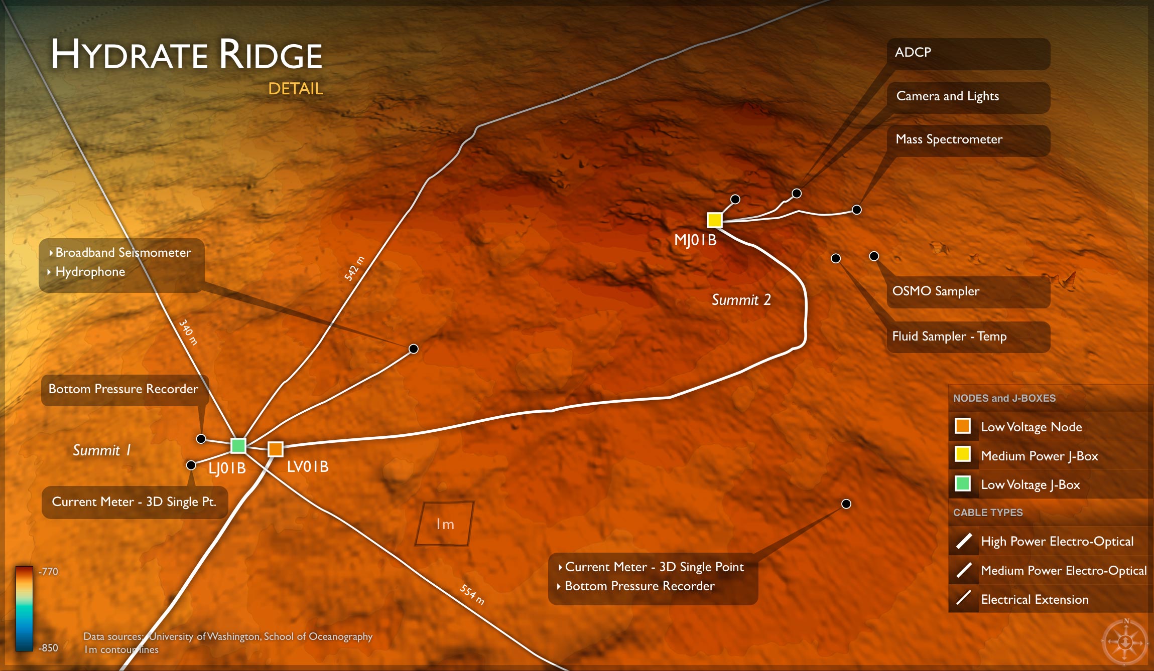
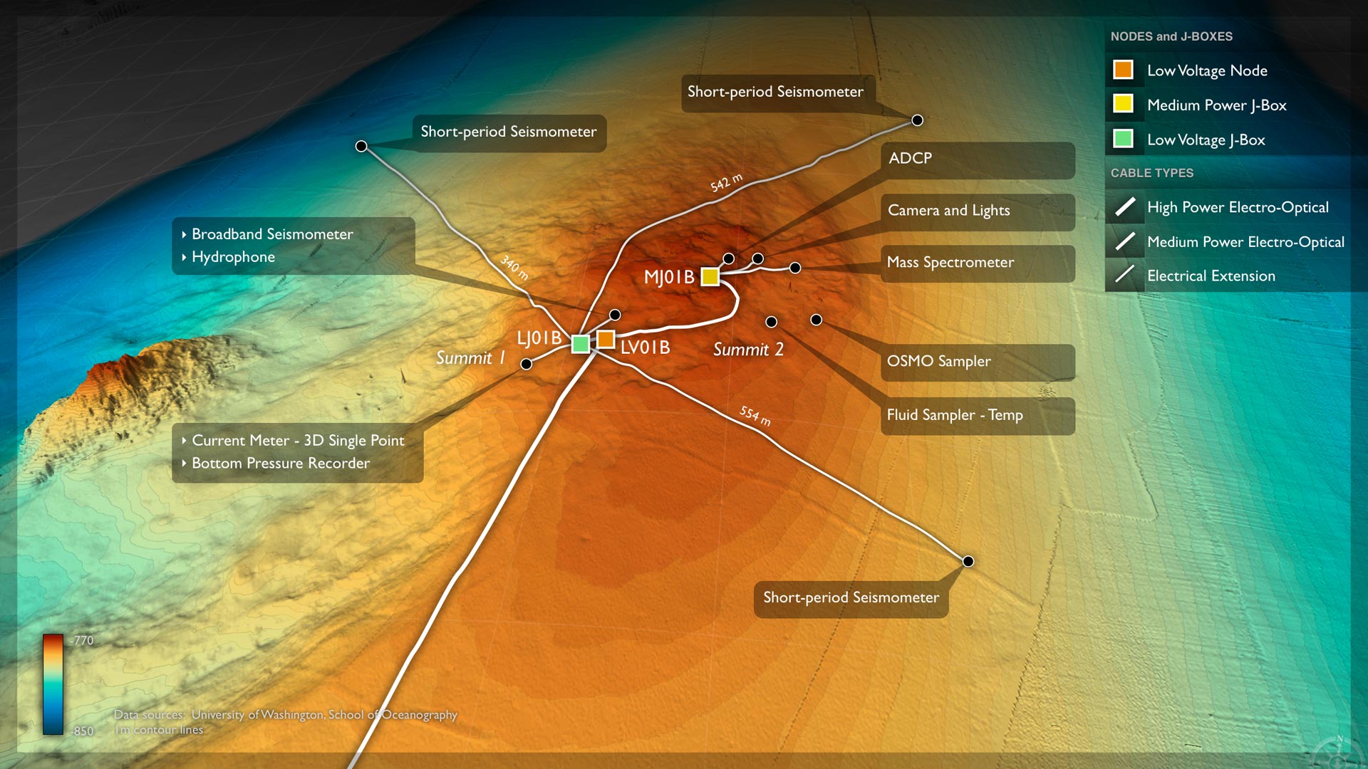
Hydrate Ridge Details image

The coastal oceans and associated ecosystems off of the Pacific Northwest are strongly impacted by wind-driven upwelling in the spring and summer of deep, nutrient-rich water. Satellite images highlight blooms of chlorophyll associated with these events that typically last 2-20 days.

A variety of sensors will be deployed on the RSN cabled network in 2013 to investigate the dynamic environment of methane seeps, gas hydrate formation, and associated biological communities. The instruments include seismometers to detect earthquake, fluid flow sensors, digitial still cameras, and a mass spectrometer for quanitfication of gas compositions.

Location of the 900 km high-power and bandwidth US Regional Scale Nodes cabled observatory in the Northeast Pacific. The backbone cables and seven primary nodes provide power and bandwidth to secondary infrastructure (instruments, junction boxes, medium power nodes, full water column moorings) at key scientific study sites along the Juan de Fuca plate and in the overlying ocean. A shore station located at Pacific City, Oregon brings the power and communications onshore where data are passed off to the terrestrial fiber. Real-time capabilities of the RSN through the Internet will provide unprecedented data flow and two-way communications to many hundreds of sensors. OOI infrastructure also includes a series of uncabled moorings as part of the Coastal Scale nodes, with data transmission through satellite communications.

RSN is developing state-of-the-art high power (3 kW) and bandwidth (1 Gbs) full water column moorings that will include a broad suite of sensors, an instrumented deep profiler, a 200 m platform and an instrumented winched shallow profiler.

The RSN spans major components of the Juan de Fuca plate (e.g. Axial Volcano, Cascadia Subduction Zone, and Southern Hydrate Ridge), and sites focused on major oceanographic processes that include upwelling along the continental margin, ocean acidification, and climate change. Backbone cable (900 km) connects 7 primary nodes, providing 8 kW power and 10 Gbs communications to secondary infrastructure at key work sites. During the VISIONS13 Expedition, 22 km of extension cables were installed, 3 J-Boxes, and a variety of sensors that await connection to the Primary Infrastructure. The system will be completed in 2014, comprising >100 seafloor and water column instruments - all connected to the Internet through the OOI Cyberinfrastructure. This observatory will provide real-time transmission of geophysical, geological, chemical, and biological data to address high priority science questions critical to understanding process linkages within our oceans.

Research Primary Image

Plan for OOI RSN Primary Node Installation. Node drawings courtesy of L-3 MariPro.

VISIONS'12 Expedition routes for legs 1 & 2.

Northeast Pacific Time-series Underwater Networked Experiments

Image of infrastructure at the summit of Axial Seamount

Image of mooring infrastructure at Axial Seamount Primary Node 3A

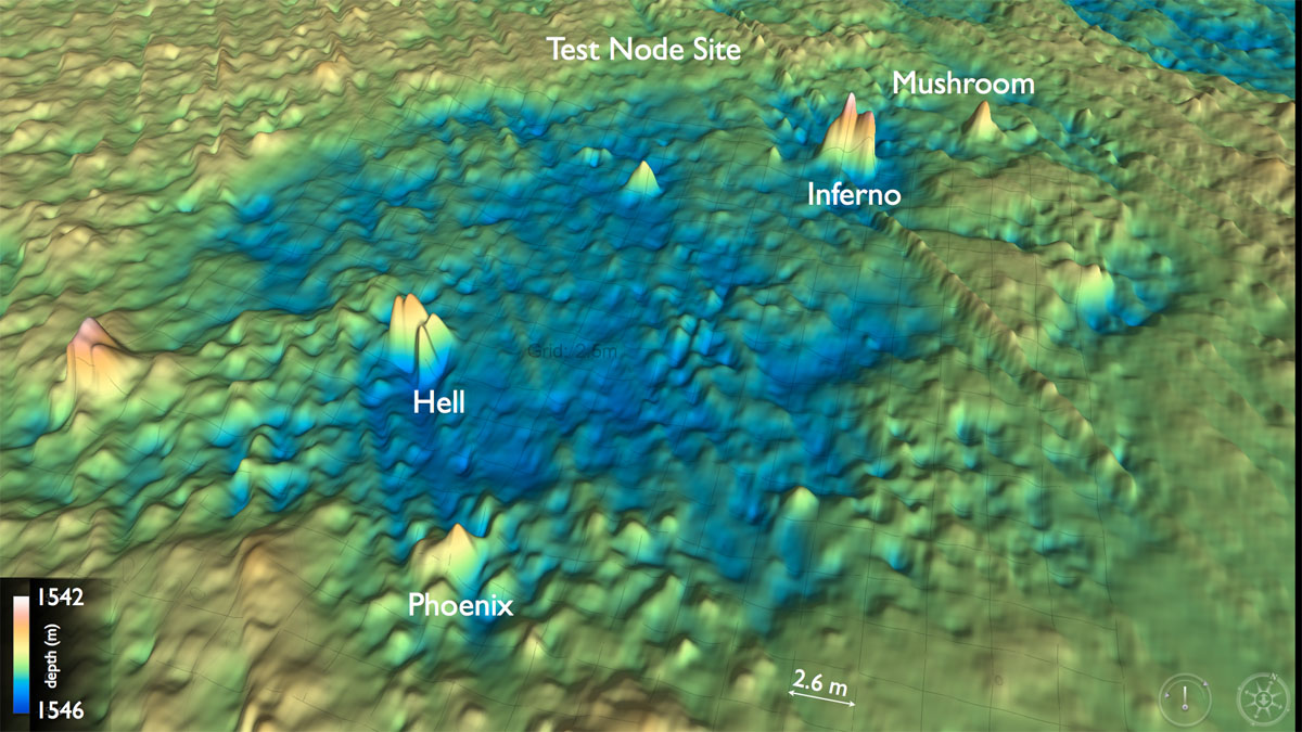
This bathymetric map of ASHES Hydrothermal Field shows the location of many of the black smoker chimneys that dot this site. The chimney Inferno rises 4 m (~ 12 feet) above the surrounding seafloor and is ~ 11 meters from its neighbor called Mushroom. Colleagues from NOAA-PMEL have worked at this site for two decades, monitoring changes in the chimneys and fluid chemistry.

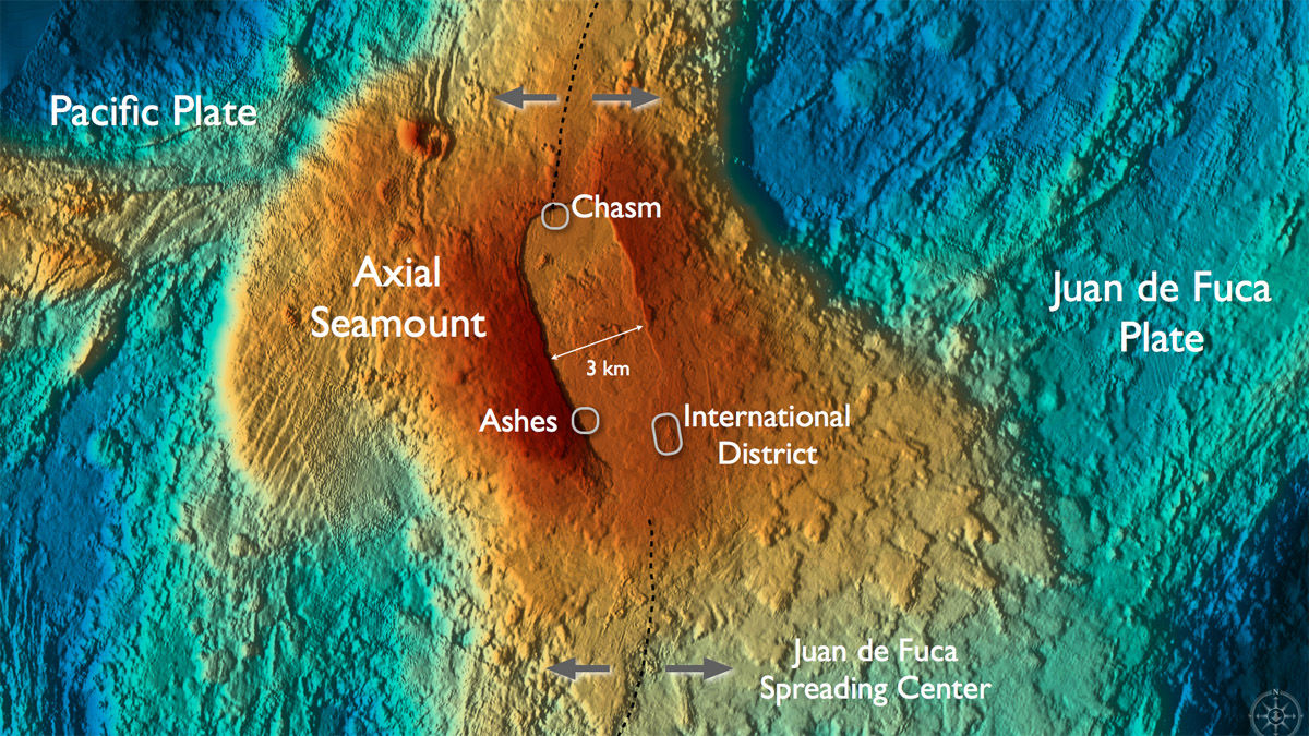
Axial Volcano hosts numerous hydrothermal fields and sites of diffuse flow that support dense animal and microbial communities. Credit: D. Kelley, University of Washington.

Theme IV banner

The dive route for the Slocum Glider at Axial Seamount.

The OOI Regional Scale Nodes cabled observatory is currently under construction. Nodes with arrays of instruments will be placed at Axial Seamount and Hydrate Ridge. Future node sites are also indicated.

The Coastal, Regional, and Global components of the OOI.

Cable Landing Invite Image

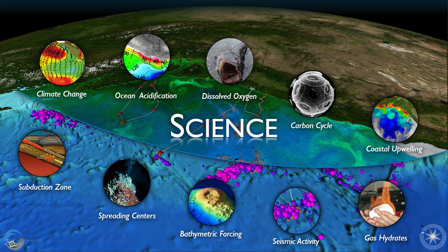
RSN Science Themes

Axial Seamount

Planned sites for Legs 1 & 2 of VISIONS'11
- Anemone
- Animal
- Arthropod
- ASHES
- Axial
- Axial Base
- Axial Biology
- Axial Caldera
- Bacteria
- Basalt Lava
- BEP
- Biofouling
- biolgoy
- Biology
- Camds
- Camera
- Camhd
- Central Caldera
- Ciliates
- Cnidaria
- Coastal Biology
- Crab
- Deep Profiler Mooring
- Dive Highlights
- Eastern Caldera
- Echinoderms
- Endurance Array
- Engineering Team
- ENLIGHTEN 10
- Exploratorium
- Fish
- Geology
- HD Camera
- HPIES
- Hydrate Ridge
- Hydrates
- Hydrophone
- Hydrothermal Vents
- Illustration
- Inshore 80 Meters
- Instrument
- International District
- J-BOX
- Jason
- Jellyfish
- Junction Box
- K12
- Lava
- Mollusk
- Moorings
- Nodes
- Nudibranch
- Octopus
- OOI
- Oregon Offshore
- Oregon Offshore 600 m
- Oregon Shelf
- Oregon Slope Base
- People
- PN1B
- PN1D
- Polychaetes
- PPSDN
- Primary Node
- RASFL
- ROCLS
- ROPOS
- ROPOS Dives
- ROV Team
- RV Revelle
- RV Sikuliaq
- RV Thompson
- Salp
- Sample
- SC13
- Science Team
- Sea Cucumber
- Sea Star
- Sea Urchin
- Seafloor
- Seismometer
- Sensors
- Shallow Profiler Mooring
- Shark
- Shipboard
- Shore Station
- Slope Base
- Smoker
- Soft Coral
- Southern Hydrate Ridge
- Sponge
- Squid
- Students
- Students & Guest Participants
- Tmpsf
- Tubeworms
- VISIONS 11 Leg 1
- VISIONS 11 Leg 2
- VISIONS 11 Viewers
- VISIONS 13
- VISIONS 14
- VISIONS 15
- VISIONS 16
- VISIONS 17
- VISIONS 18
- VISIONS 20
- VISIONS 22
- VISIONS 23
- Visualization
