Image Archive


A "snow storm" of material in the shallow waters (80 m) off of Newport, Oregon prevented the ROV Jason from recovering and redeploying the Bethic Experiment Platform during the first two dives of the VISIONS'17 program. These waters are some of the most biologically productive in the worlkds' oceans. Credit: UW/OOI-NSF/WHOI; V17.

The hydrophone (an underwater microphone) connected to the Benthic Experiment Package (BEP) at the Oregon Shelf site, in 80 meters of water. Photo Credit: NSF/UW/CSSF, Dive R1801, V14

A lingcod resting on the seafloor next to the hydrophone cable at the Oregon Shelf (80m) site. Photo Credit: NSF/UW/CSSF, Dive R1801, V14

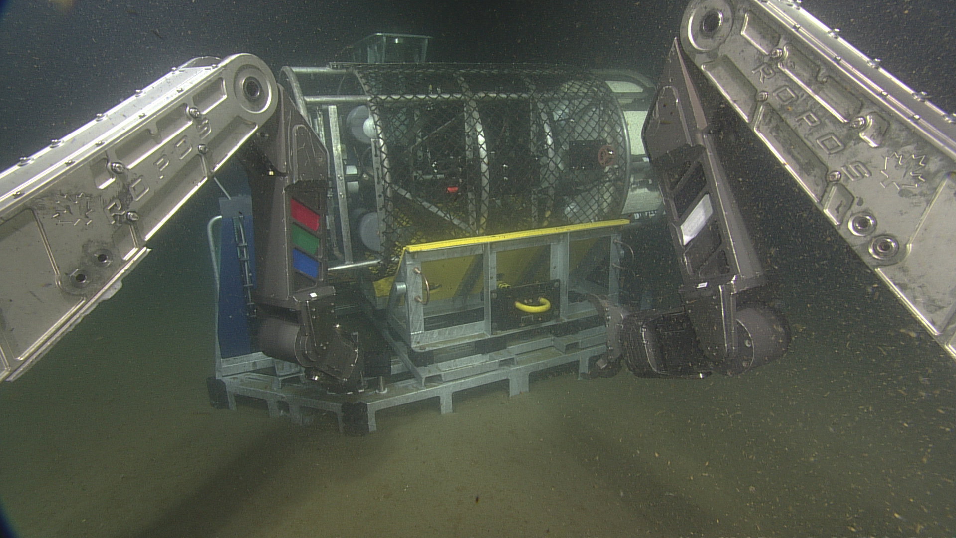
The cabled coastal surface-piercing profiler (cCSPP) was delivered to the seafloor by ROPOS and placed roughly 12 meters due East of the medium-powered junction box MJ01C at the Oregon Shelf site, in 79 meters of water. The cylindrical sensor pod of the cCSPP (left side of image) will float freely in the water column after being released from the deployment cradle on the profiler base. Once powered up, the sensor pod will move up and down in the water column at least 4 times per day, taking samples continuously using the onboard CTD, oxygen, fluorometer, nitrate, AC-S, PAR sensor, spectral irradiance, and 3D water velocity sensors. Photo Credit: NSF/UW/CSSF, Dive R1801, V14

ROPOS using the starboard manipulator to pull the release that allowed the sensor pod of the cabled coastal surface-piercing profiler (cCSPP) to swing upwards and float freely in the water. The cCSPP was delivered to the seafloor and placed roughly 12 meters due East of the medium-powered junction box MJ01C at the Oregon Shelf site, in 79 meters of water. Photo Credit: NSF/UW/CSSF, Dive R1801, V14

The sensor pod of the cabled coastal surface-piercing profiler (cCSPP) floating freely in the water column after being released from the deployment cradle on the profiler base. Once powered up, the sensor pod will move up and down in the water column at least 4 times per day, taking samples continuously using the onboard CTD, oxygen, fluorometer, nitrate, AC-S, PAR sensor, spectral irradiance, and 3D water velocity sensors. Photo Credit: NSF/UW/CSSF, Dive R1801, V14
- Anemone
- Animal
- Arthropod
- ASHES
- Axial
- Axial Base
- Axial Biology
- Axial Caldera
- Bacteria
- Basalt Lava
- BEP
- Biofouling
- biolgoy
- Biology
- Camds
- Camera
- Camhd
- Central Caldera
- Ciliates
- Cnidaria
- Coastal Biology
- Crab
- Deep Profiler Mooring
- Dive Highlights
- Eastern Caldera
- Echinoderms
- Endurance Array
- Engineering Team
- ENLIGHTEN 10
- Exploratorium
- Fish
- Geology
- HD Camera
- HPIES
- Hydrate Ridge
- Hydrates
- Hydrophone
- Hydrothermal Vents
- Illustration
- Inshore 80 Meters
- Instrument
- International District
- J-BOX
- Jason
- Jellyfish
- Junction Box
- K12
- Lava
- Mollusk
- Moorings
- Nodes
- Nudibranch
- Octopus
- OOI
- Oregon Offshore
- Oregon Offshore 600 m
- Oregon Shelf
- Oregon Slope Base
- People
- PN1B
- PN1D
- Polychaetes
- PPSDN
- Primary Node
- RASFL
- ROCLS
- ROPOS
- ROPOS Dives
- ROV Team
- RV Revelle
- RV Sikuliaq
- RV Thompson
- Salp
- Sample
- SC13
- Science Team
- Sea Cucumber
- Sea Star
- Sea Urchin
- Seafloor
- Seismometer
- Sensors
- Shallow Profiler Mooring
- Shark
- Shipboard
- Shore Station
- Slope Base
- Smoker
- Soft Coral
- Southern Hydrate Ridge
- Sponge
- Squid
- Students
- Students & Guest Participants
- Tmpsf
- Tubeworms
- VISIONS 11 Leg 1
- VISIONS 11 Leg 2
- VISIONS 11 Viewers
- VISIONS 13
- VISIONS 14
- VISIONS 15
- VISIONS 16
- VISIONS 17
- VISIONS 18
- VISIONS 20
- VISIONS 22
- VISIONS 23
- Visualization
