Image Archive









OOI Map with RSN inset

OOI RSN cable system map

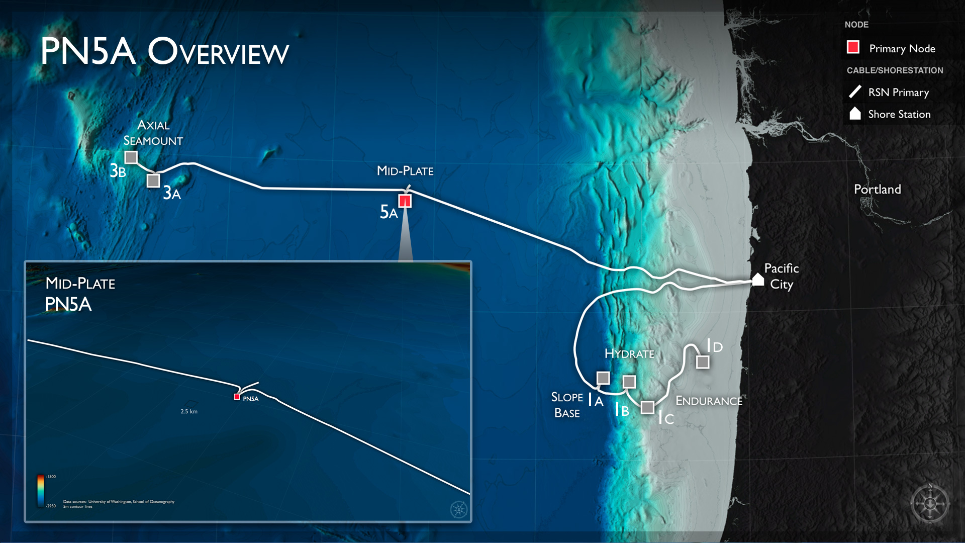
PN5A-Overview Image

PN3B-Overview Image

PN3A-Overview Image

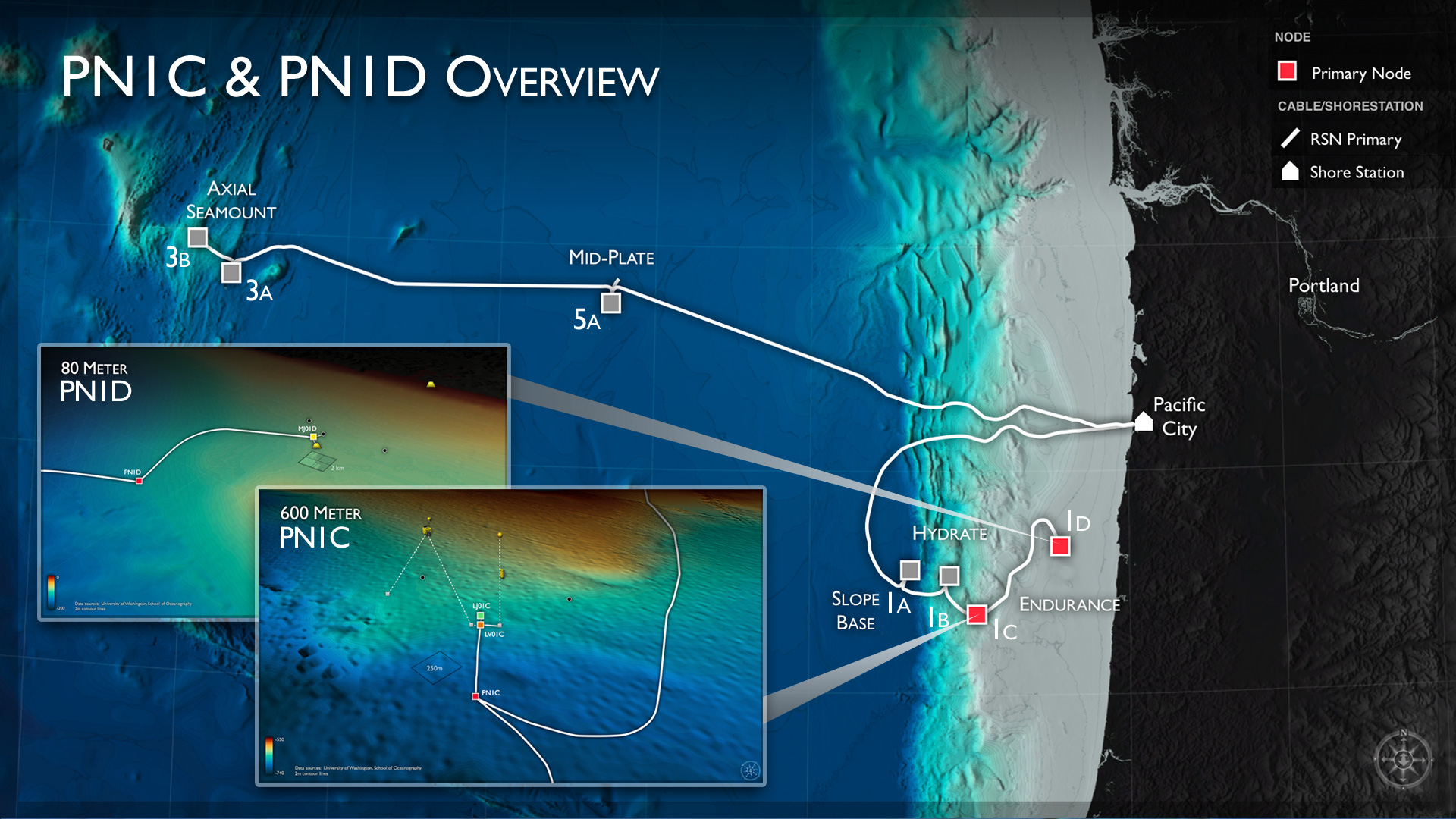
PN1C and PN1D-Overview Image

PN1B-Overview Image

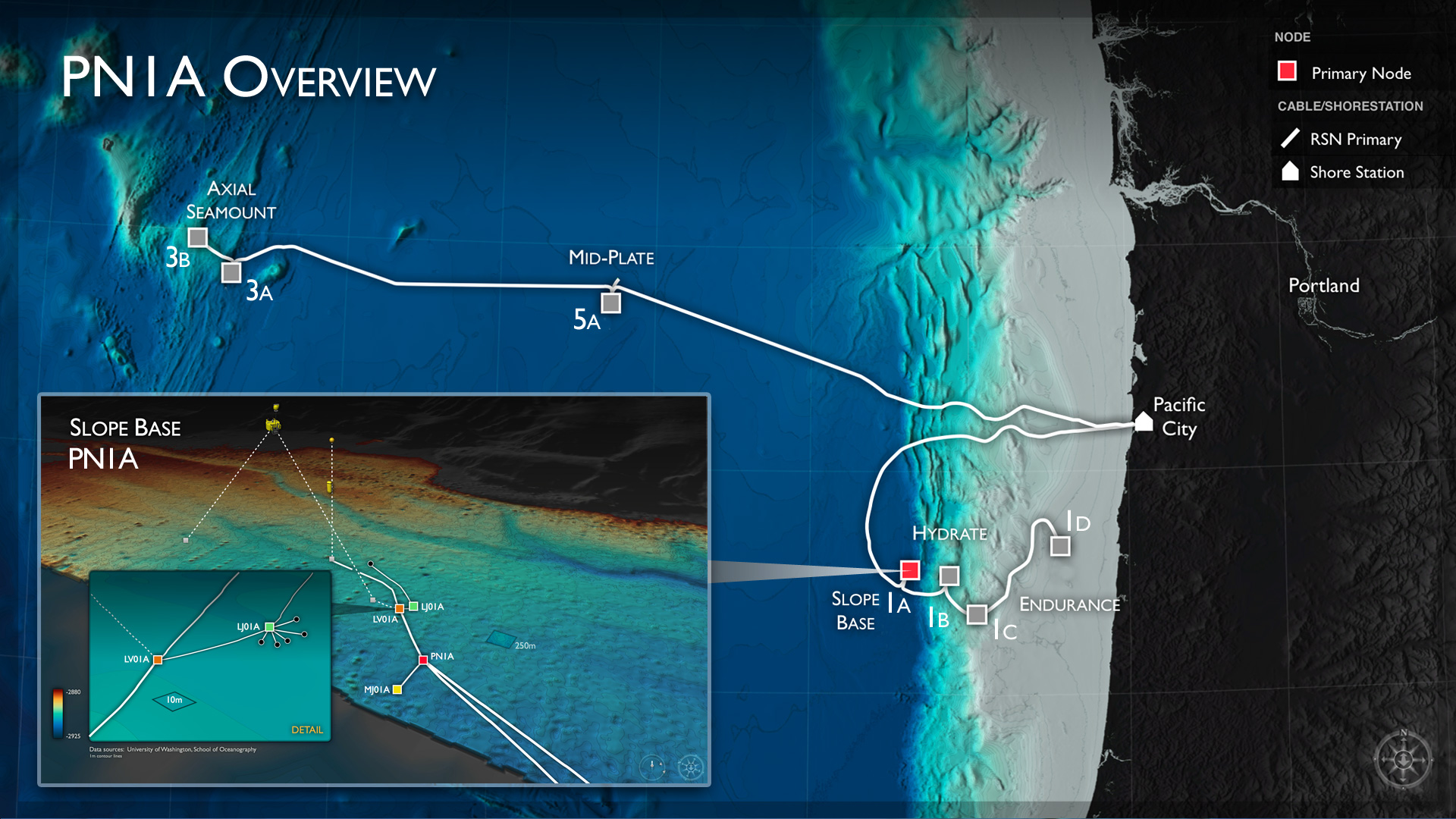
PN1A-Overview Image

Axial Caldera Image

Location of nodes, cables and instruments to be deployed during the VISIONS'13 expedition at, and near, the ASHES Hydrothermal Vent Field.

The cabled geophysical array at the Central Caldera Site is focused on measuring the inflation and deflation of the volcano, earthquakes, and the movement of of molten lava within the core of the volcano. Bathymetric data are from D. Clague and D. Caress, MBARI. Image Credit: University of Washington.

Endurance Array and Slope Base Mooring Image

V'13 Live Video Banner

VISIONS'13 Banner with Updates text

VISIONS13-nolivebutton banner

V13 Image No Schedule

VISIONS'13 Expedition Map

Locations and transits planned for the VISIONS'13 Expedition

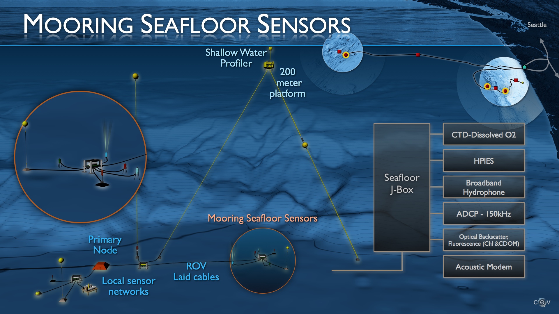
RSN is developing state-of-the-art high power (3 kW) and bandwidth (1 Gbs) full water column moorings that will include a broad suite of sensors, an instrumented deep profiler, a 200 m platform and an instrumented winched shallow profiler.

Expeditions Primary Image

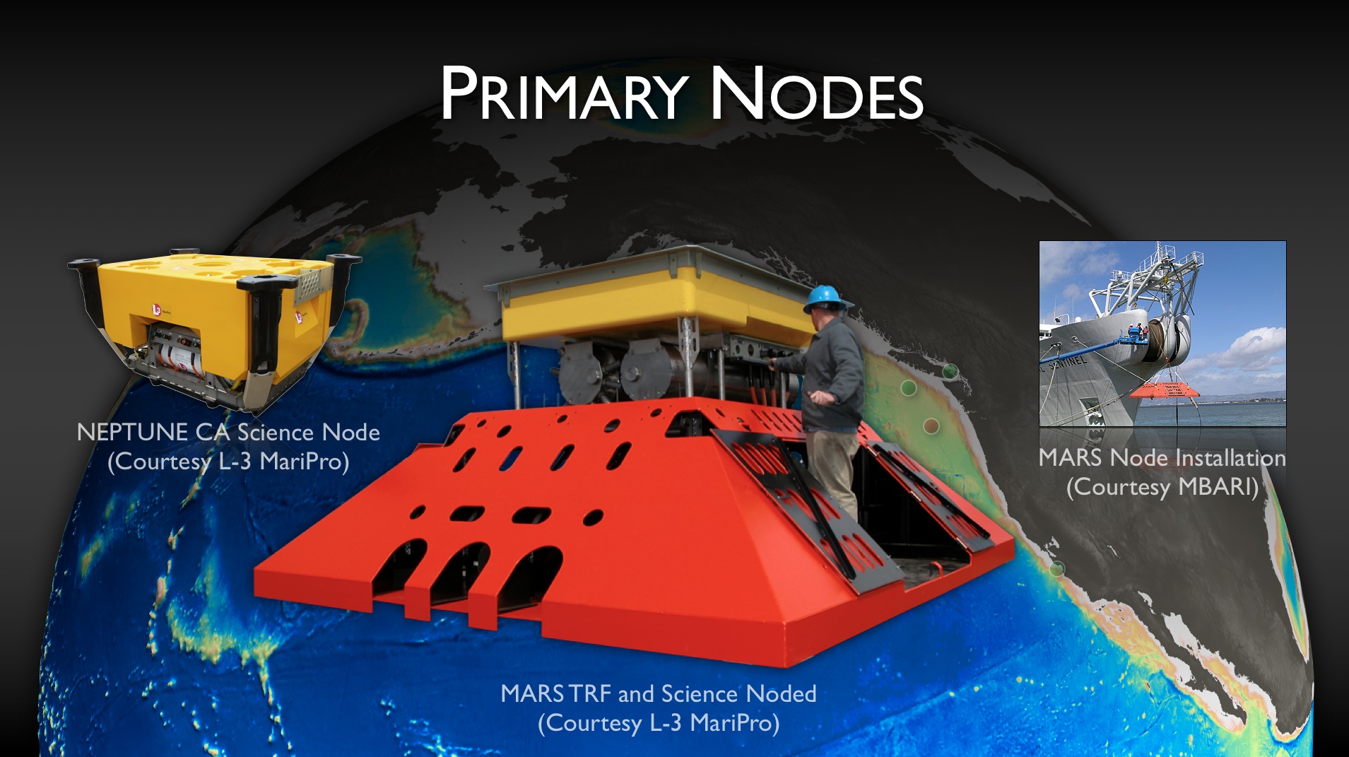
Plan for OOI RSN Primary Node Installation. Node drawings courtesy of L-3 MariPro.

Opportunities Image

Image of infrastructure at the summit of Axial Seamount

Image of mooring infrastructure at Axial Seamount Primary Node 3A

Components of the primary nodes include the backbone interface assembly (red frame) and the science interface assembly (yellow).

Components of the core seafloor sensor packages associated with the OOI cabled observatory moorings

Components of the OOI cabled observatory deep water profilers

Components of the 200m platforms on the OOI cabled observatory moorings
- Anemone
- Animal
- Arthropod
- ASHES
- Axial
- Axial Base
- Axial Biology
- Axial Caldera
- Bacteria
- Basalt Lava
- BEP
- Biofouling
- biolgoy
- Biology
- Camds
- Camera
- Camhd
- Central Caldera
- Ciliates
- Cnidaria
- Coastal Biology
- Crab
- Deep Profiler Mooring
- Dive Highlights
- Eastern Caldera
- Echinoderms
- Endurance Array
- Engineering Team
- ENLIGHTEN 10
- Exploratorium
- Fish
- Geology
- HD Camera
- HPIES
- Hydrate Ridge
- Hydrates
- Hydrophone
- Hydrothermal Vents
- Illustration
- Inshore 80 Meters
- Instrument
- International District
- J-BOX
- Jason
- Jellyfish
- Junction Box
- K12
- Lava
- Mollusk
- Moorings
- Nodes
- Nudibranch
- Octopus
- OOI
- Oregon Offshore
- Oregon Offshore 600 m
- Oregon Shelf
- Oregon Slope Base
- People
- PN1B
- PN1D
- Polychaetes
- PPSDN
- Primary Node
- RASFL
- ROCLS
- ROPOS
- ROPOS Dives
- ROV Team
- RV Revelle
- RV Sikuliaq
- RV Thompson
- Salp
- Sample
- SC13
- Science Team
- Sea Cucumber
- Sea Star
- Sea Urchin
- Seafloor
- Seismometer
- Sensors
- Shallow Profiler Mooring
- Shark
- Shipboard
- Shore Station
- Slope Base
- Smoker
- Soft Coral
- Southern Hydrate Ridge
- Sponge
- Squid
- Students
- Students & Guest Participants
- Tmpsf
- Tubeworms
- VISIONS 11 Leg 1
- VISIONS 11 Leg 2
- VISIONS 11 Viewers
- VISIONS 13
- VISIONS 14
- VISIONS 15
- VISIONS 16
- VISIONS 17
- VISIONS 18
- VISIONS 20
- VISIONS 22
- VISIONS 23
- Visualization
