Image Archive


Deep water and shallow water profiling components of the OOI cabled observatory moorings

Secondary nodes will connect to the primary nodes and transfer power and bandwidth to sensor networks. They are scheduled for deployment in 2013 using an ROV. --Graphic credit: OOI RSN and Center for Environmental Visualization, University of Washington

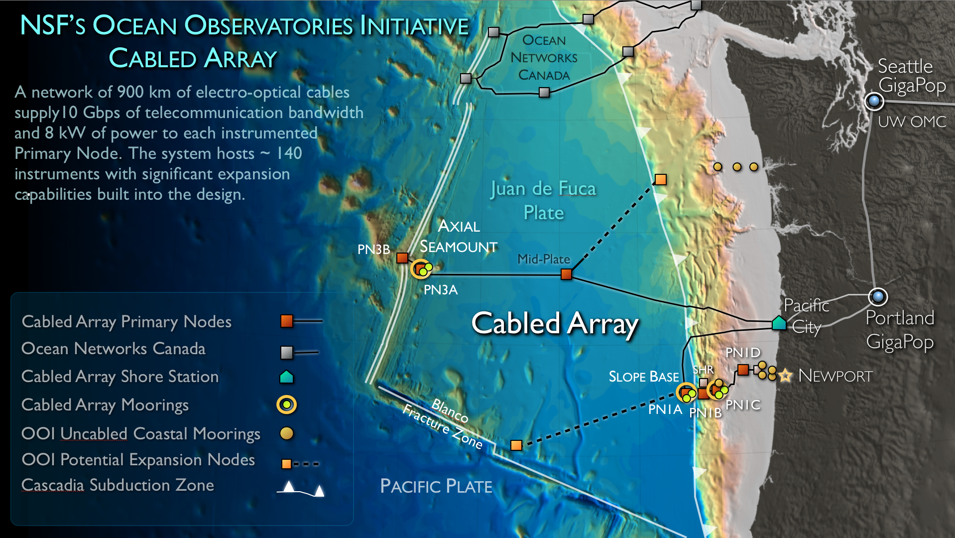
The footprint of the OOI cabled observatory

OOI primary nodes

Extension cables will connect the primary nodes to secondary nodes and then to myriad instruments and sensors. Over 22,000 m of extension cables were deployed with the remotely operated vehicle ROPOS during the VISIONS'13 expedition, July - August, 2013.

Highly capable moorings such as those shown here use power and bandwidth from the cable to investigate water motion and a spectrum of other properties from the sea surface to the seafloor.

The Cascadia Subduction Zone (CSZ) just west of Washington and Oregon is of particular interest to experts assessing tsunami danger to the US and Canada. The CSZ stretches from Northern CA's Cape Mendocino to souther Bristish Columbia.

Lithosphere to hydrosphere processes at Endeavour.

Modifications to the RSN cabled observatory suggested at the RSN-Axial Workshop in Seattle, WA October 5-7, 2011.

OOI RSN cable installation was completed on 5 September 2011.

The dive route for the Slocum Glider at Axial Seamount.

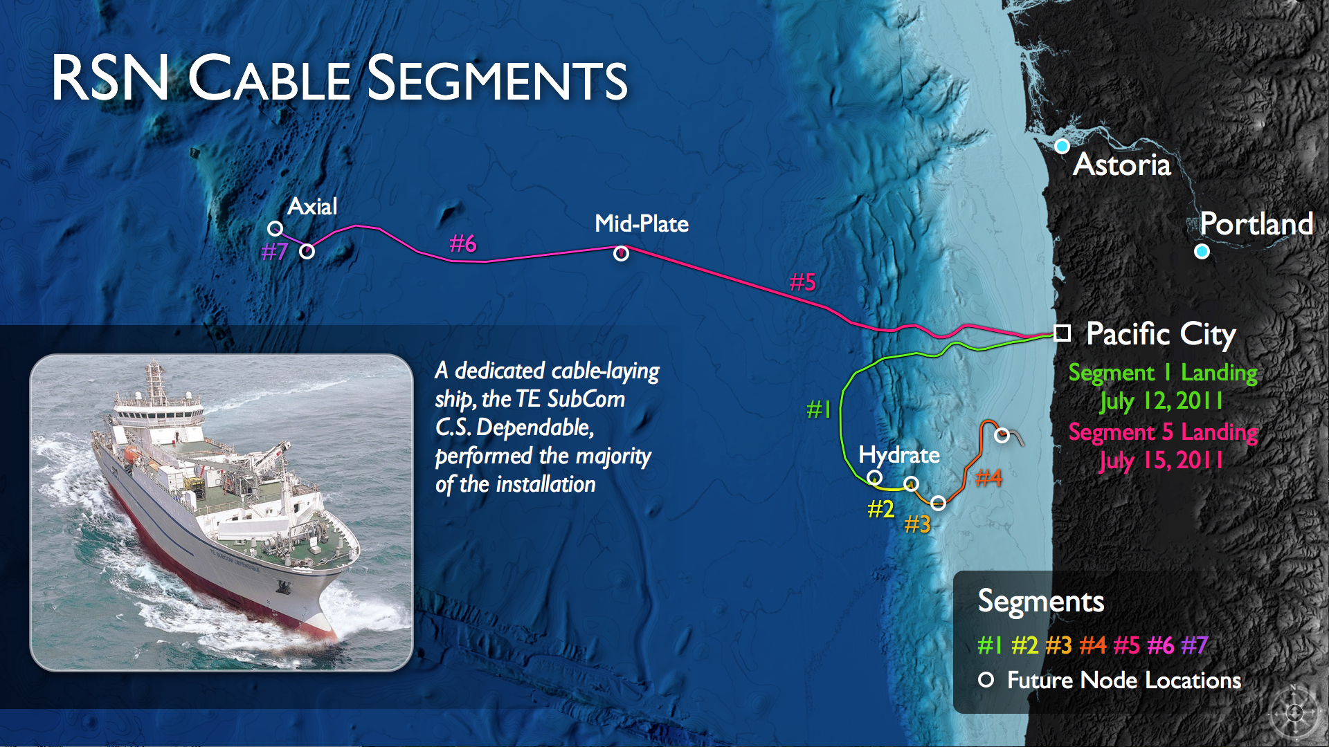
The OOI cable for the regional component is being laid in segments, as shown on this graphic.

Cable Landing Invite Image

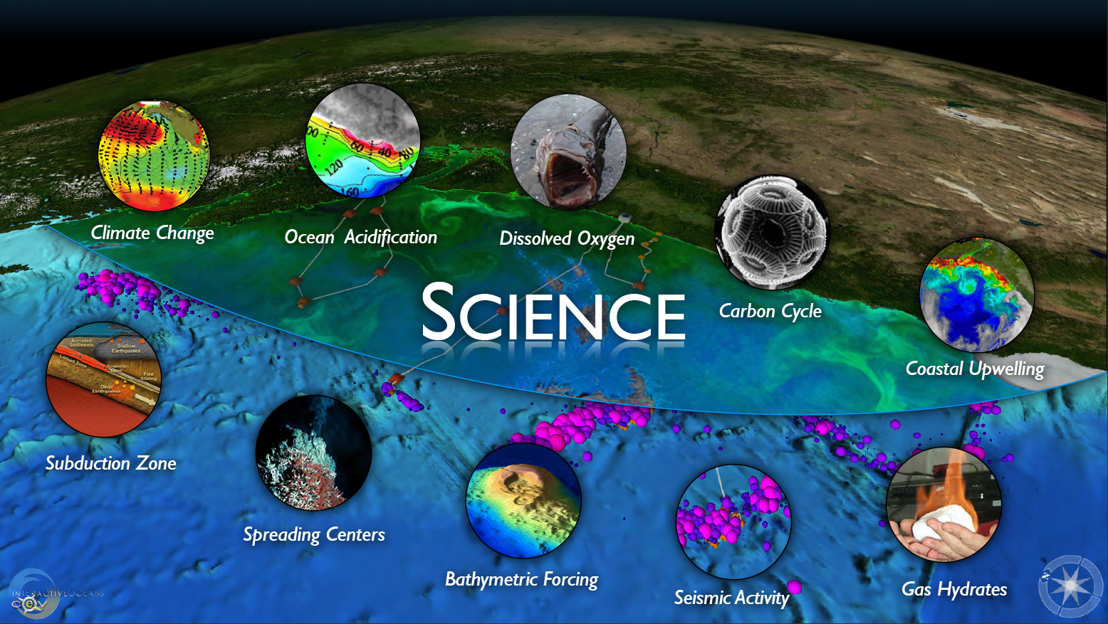
RSN Science Themes

HDD Cross-section

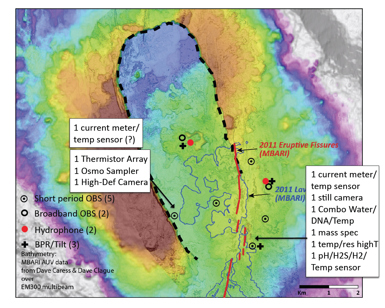
Sensor Configurations Image
- Anemone
- Animal
- Arthropod
- ASHES
- Axial
- Axial Base
- Axial Biology
- Axial Caldera
- Bacteria
- Basalt Lava
- BEP
- Biofouling
- biolgoy
- Biology
- Camds
- Camera
- Camhd
- Central Caldera
- Ciliates
- Cnidaria
- Coastal Biology
- Crab
- Deep Profiler Mooring
- Dive Highlights
- Eastern Caldera
- Echinoderms
- Endurance Array
- Engineering Team
- ENLIGHTEN 10
- Exploratorium
- Fish
- Geology
- HD Camera
- HPIES
- Hydrate Ridge
- Hydrates
- Hydrophone
- Hydrothermal Vents
- Illustration
- Inshore 80 Meters
- Instrument
- International District
- J-BOX
- Jason
- Jellyfish
- Junction Box
- K12
- Lava
- Mollusk
- Moorings
- Nodes
- Nudibranch
- Octopus
- OOI
- Oregon Offshore
- Oregon Offshore 600 m
- Oregon Shelf
- Oregon Slope Base
- People
- PN1B
- PN1D
- Polychaetes
- PPSDN
- Primary Node
- RASFL
- ROCLS
- ROPOS
- ROPOS Dives
- ROV Team
- RV Revelle
- RV Sikuliaq
- RV Thompson
- Salp
- Sample
- SC13
- Science Team
- Sea Cucumber
- Sea Star
- Sea Urchin
- Seafloor
- Seismometer
- Sensors
- Shallow Profiler Mooring
- Shark
- Shipboard
- Shore Station
- Slope Base
- Smoker
- Soft Coral
- Southern Hydrate Ridge
- Sponge
- Squid
- Students
- Students & Guest Participants
- Tmpsf
- Tubeworms
- VISIONS 11 Leg 1
- VISIONS 11 Leg 2
- VISIONS 11 Viewers
- VISIONS 13
- VISIONS 14
- VISIONS 15
- VISIONS 16
- VISIONS 17
- VISIONS 18
- VISIONS 20
- VISIONS 22
- VISIONS 23
- Visualization
