Image Archive


Arriving at the Thompson after a 6-hour drive down to Newport. Credit: V. Kondrat, University of Washington; V23.

Vivi

The R/V Thompson pulling away from the NOAA dock in Newport, Oregon. Credit: R. Newell, University of Washington; V23.

Rowan

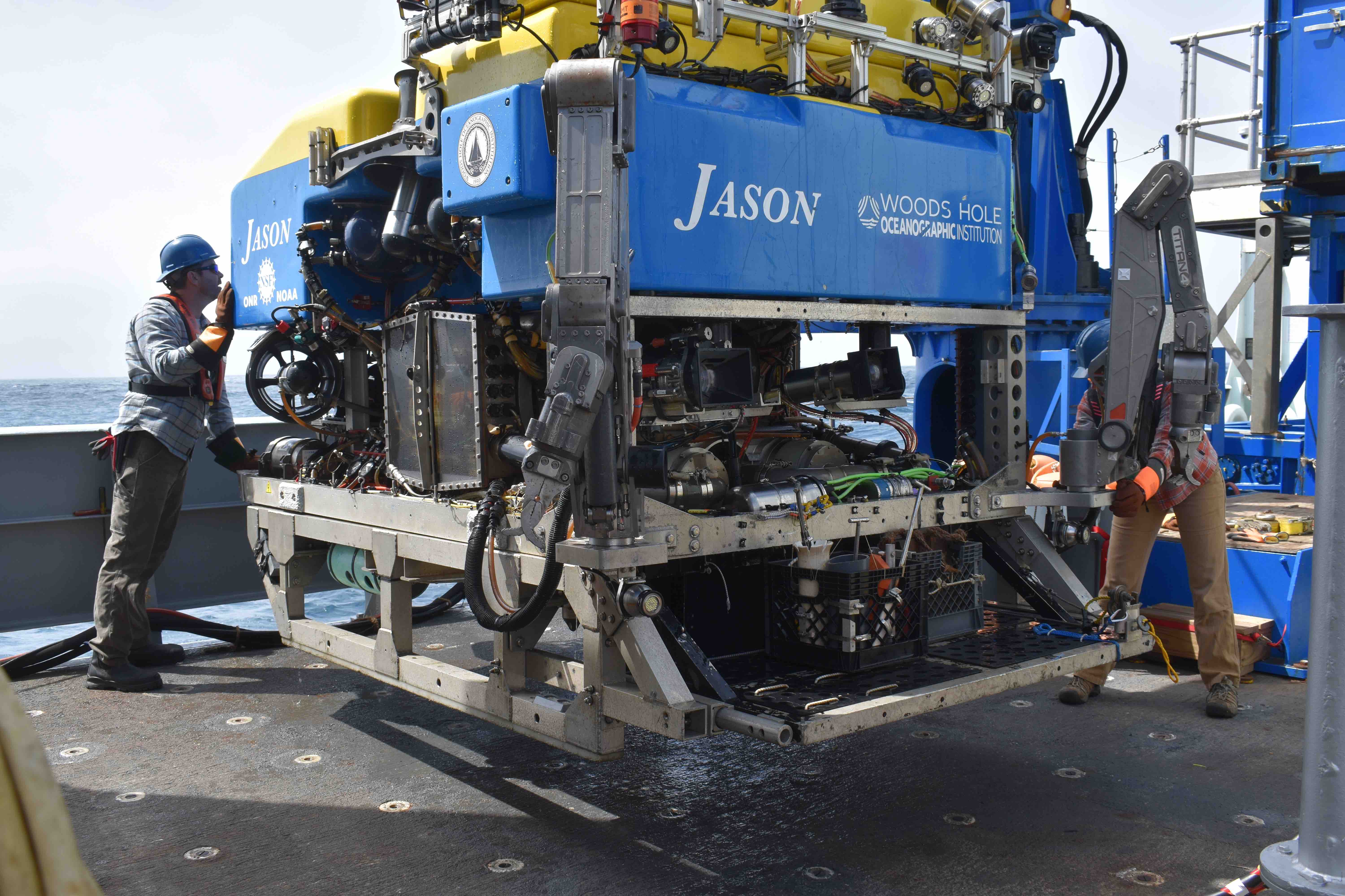
The ROV Jason sitting on the deck of R/V Thompson. Credit: R. Newell, University of Washington; V23.

Pulling Away figure 2 copy

The ROV Jason on Thompsons fantail at the start of Leg 4. Credit: M. Kidiwela, University of Washington, V23.

The R/V Thompson leaving the port at the start of Leg 4. Credit: M. Kidiwela, University of Washington, V23.

Jason at the dock.Figure 1 copy

Maleen

Kristine

CTD-005 coming up to the surface. Credit: Kristine Prado-Casillas; V23

Cameron

Biofouling community of anemone and scallops, taxa unspecific. Credit: A. Carter, University of Washington; V23.

ROV Jason Control van. Credit: A. Carter, University of Washington; V23.

Biofouling community of crinoids, plumose anemone and fish on the Offshore Deep Profiler Mooring being serviced by the ROV Jason. Credit: A. Carter, University of Washington; V23.

Atticus

Our walk along the estuary. Credit: Aakriti Vijay, University of Washington, V23.

Aakriti

Recovery of Jason after Dive J2-1548 to the Oregon Offshore (PD01B) mooring. Credit: J. Thirtyacre, University of Washington; V23.

R/V Thompson under the stars at the Endurance Array Offshore site. Credit: J. Thirtyacre, University of Washington; V23.

Sunrise at the Regional Cabled Array Offshore site. Credit: J. Thirtyacre, University of Washington; V23.

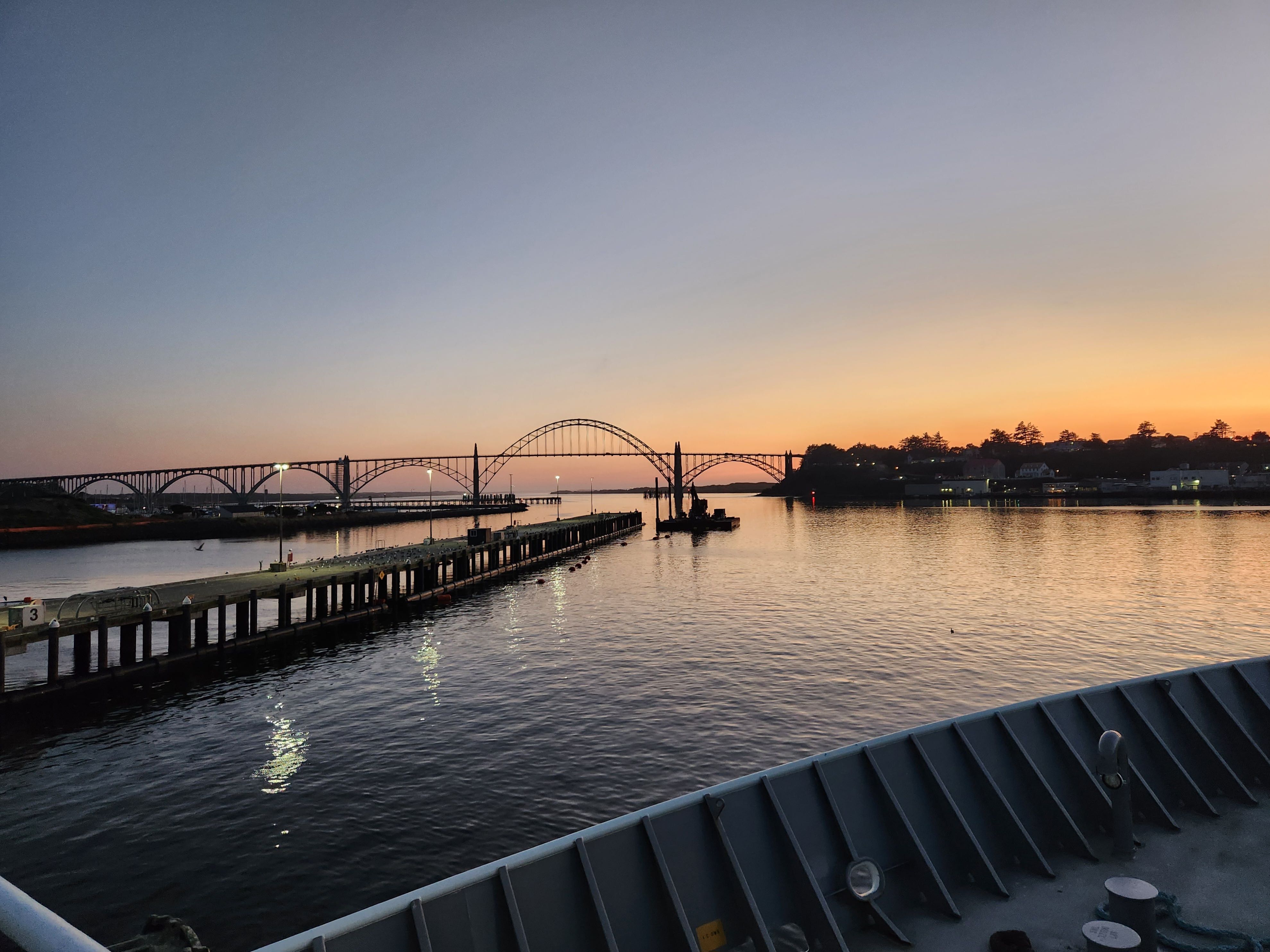
Sunset over the bow of the R/V Thompson while leaving the NOAA port in Newport, Oregon. Credit: J. Thirtyacre, University of Washington; V23.

Thomas G. Thompson docked at the NOAA Marine Operations Center-Pacific, Newport, Oregon facility. Credit: J. Thirtyacre, University of Washington; V23.

RCA isobaric gas-tight samplers in the Bio Analytical Lab. Credit: J. Thirtyacre, University of Washington; V23.

Jolee

The "pig" control unit (top left) and the blue temperature and resistivity probe after it was inserted into a 340 ºC vent chimney at "Diva" vent in the International District vent field. Credit: UW/NSF-OOI/WHOI, Dive J2-1546, V23.

With shoreside assistance from Marv Lilley, Jason carefully inserted this temperature and resistivity probe into a 340 ºC vent chimney at Diva vent in the International District vent field. Credit: UW/NSF-OOI/WHOI, Dive J2-1546, V23.
- Anemone
- Animal
- Arthropod
- ASHES
- Axial
- Axial Base
- Axial Biology
- Axial Caldera
- Bacteria
- Basalt Lava
- BEP
- Biofouling
- biolgoy
- Biology
- Camds
- Camera
- Camhd
- Central Caldera
- Ciliates
- Cnidaria
- Coastal Biology
- Crab
- Deep Profiler Mooring
- Dive Highlights
- Eastern Caldera
- Echinoderms
- Endurance Array
- Engineering Team
- ENLIGHTEN 10
- Exploratorium
- Fish
- Geology
- HD Camera
- HPIES
- Hydrate Ridge
- Hydrates
- Hydrophone
- Hydrothermal Vents
- Illustration
- Inshore 80 Meters
- Instrument
- International District
- J-BOX
- Jason
- Jellyfish
- Junction Box
- K12
- Lava
- Mollusk
- Moorings
- Nodes
- Nudibranch
- Octopus
- OOI
- Oregon Offshore
- Oregon Offshore 600 m
- Oregon Shelf
- Oregon Slope Base
- People
- PN1B
- PN1D
- Polychaetes
- PPSDN
- Primary Node
- RASFL
- ROCLS
- ROPOS
- ROPOS Dives
- ROV Team
- RV Revelle
- RV Sikuliaq
- RV Thompson
- Salp
- Sample
- SC13
- Science Team
- Sea Cucumber
- Sea Star
- Sea Urchin
- Seafloor
- Seismometer
- Sensors
- Shallow Profiler Mooring
- Shark
- Shipboard
- Shore Station
- Slope Base
- Smoker
- Soft Coral
- Southern Hydrate Ridge
- Sponge
- Squid
- Students
- Students & Guest Participants
- Tmpsf
- Tubeworms
- VISIONS 11 Leg 1
- VISIONS 11 Leg 2
- VISIONS 11 Viewers
- VISIONS 13
- VISIONS 14
- VISIONS 15
- VISIONS 16
- VISIONS 17
- VISIONS 18
- VISIONS 20
- VISIONS 22
- VISIONS 23
- Visualization
