Image Archive






Jason Control Van: Live feed of Jason unhooking a recovery cable off of the Half frame at PN1B. Credit: Oedekoven Pomponi, University of Washington, V21.

The Sheep (Junction Box MJ01C) recovered from the Oregon Shelf site on deck in the midst of being shorn. Credit: R. Scott, University of Washington, V21.

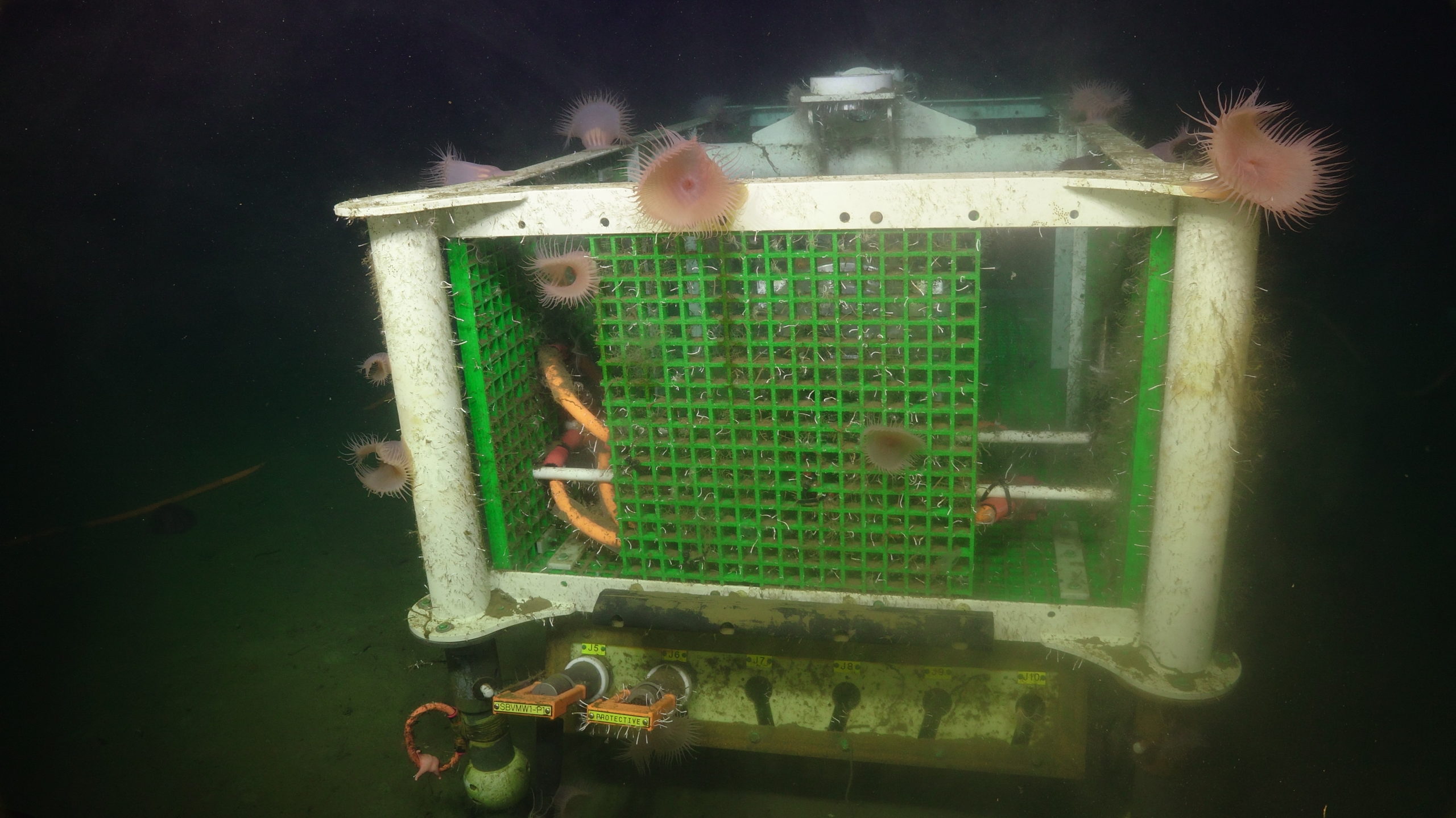
An overview of the junction box fondly called the "sheep." Credit: UW/NSF-OOI/WHOI; Dive J2-1360; V21.

An Anthomastus sp. soft coral from J2-1230. Credit: UW/WHOI; Dive J2-1230; Pythias Oasis Cruise 2019 AT42-17.

My view from inside the JASON van. Credit: H. Weinrich, University of Washington, V21.

ROV JASON being lowered over the side of the ship into the water. Credit: H. Weinrich, University of Washington, V21.

Sadie Armstron holding up two anemones that she’d pulled off the "sheep" junction box from the Shelf Site. Credit: E. Littell, University of Washington, V21.

R/V Thompson lunch board, with a printout of a Risso’s dolphin taped above it and labeled “Today’s Visitors”. Credit: E. Littell, University of Washington, V21.

A close-up of some of the giant plumose anemones or Metridium farcimen reveals just how intricate their tentacles are with finer extensions that allow them to capture even the smallest of organisms in the current. Image Credit: UW/NSF-OOI/WHOI; Dive J2-1360; V21

A side-by-side view between the old MJ01C - the “sheep”, and the new junction box to replace it reveals just how long that infrastructure has been on the seafloor as you’d be forgiven for not recognizing it. Image Credit: UW/NSF-OOI/WHOI; Dive J2-1360; V21

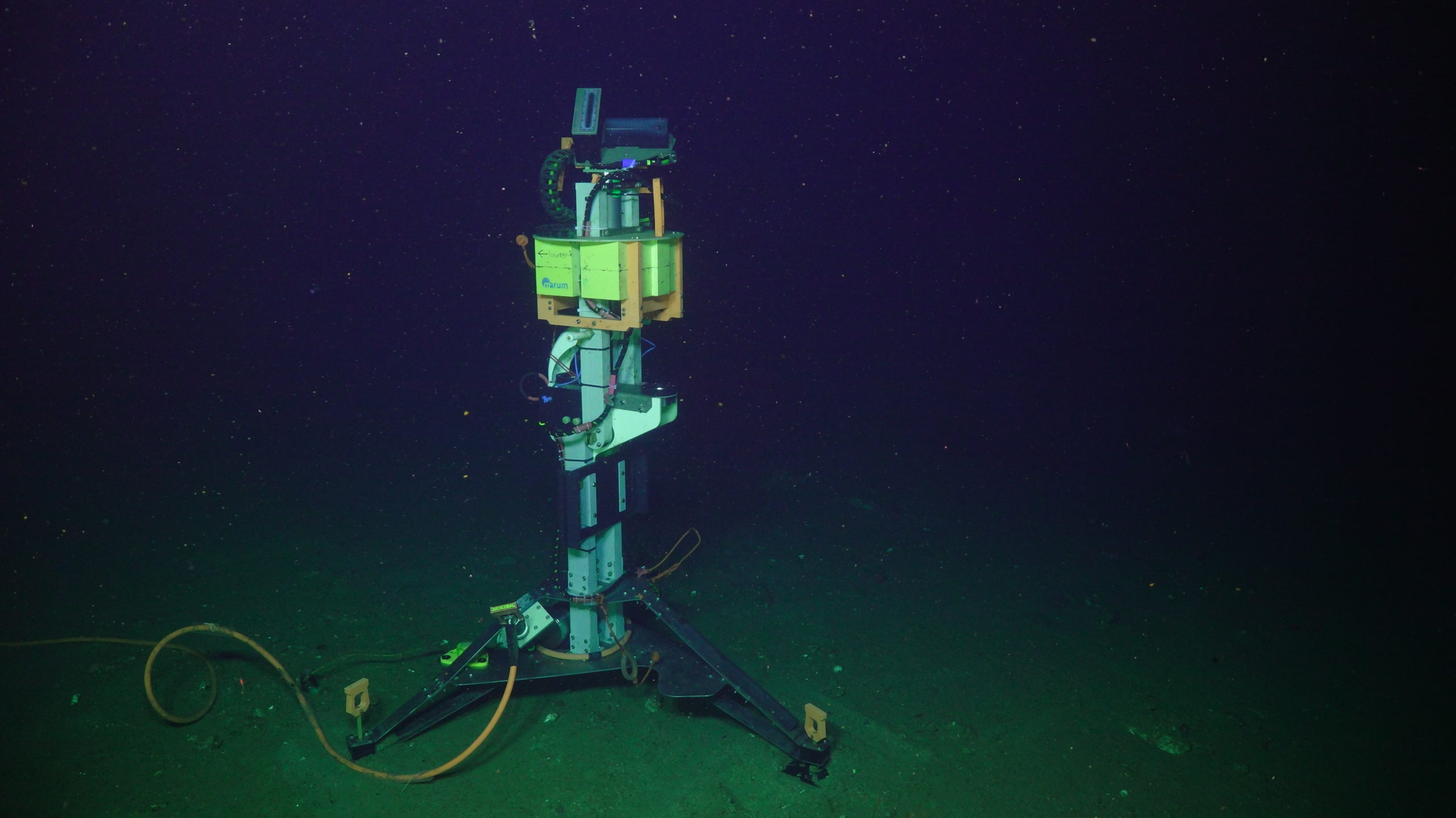
The MARUM Overview Sonar in its deployed state accompanied by an adorable lobate ctenophore, Bolinopsis infundibulum in the foreground. Credit: UW/NSF-OOI/WHOI, V21.

This low voltage junction box seen during J2-1355 was originally meant to be replaced with LV01A-2021, but due to some weather issues, it will remain at home for some sea anemones a bit longer. Image Credits: UW/NSF-OOI/WHOI; Dive J2-1355; V21

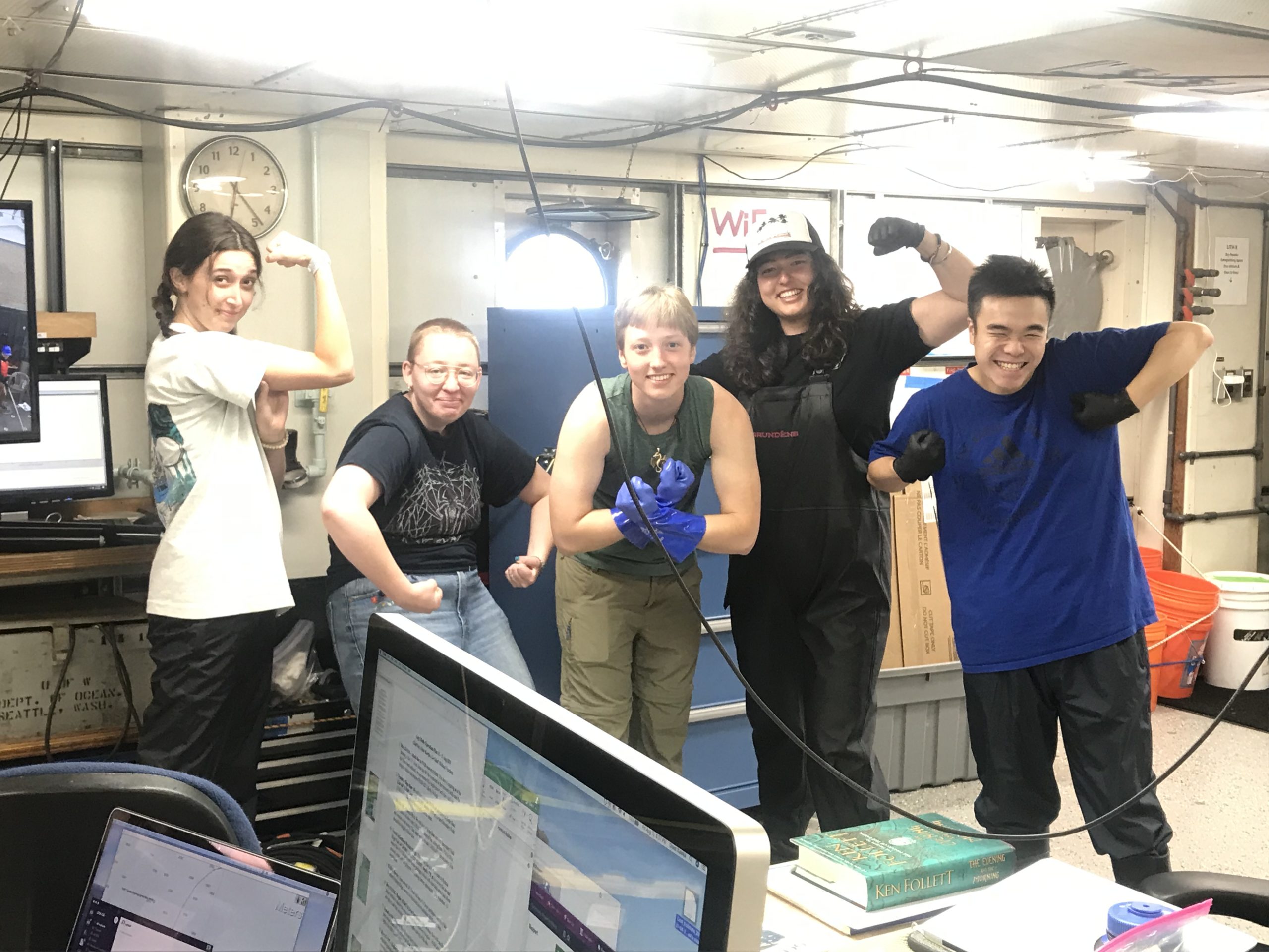
Leg 2 VISIONS'21 students excited to go wash "the sheep" - node MJ01C, which was deployed in 2014 and is now covered with sea anemones.

The German MARUM sonar deployed at Southern Hydrate Ridge during VISIONS'21. The multibeam sonar looks for naturally occurring methane bubble plumes at this site. Credit: UW/NSF-OOI/WHOI, V21

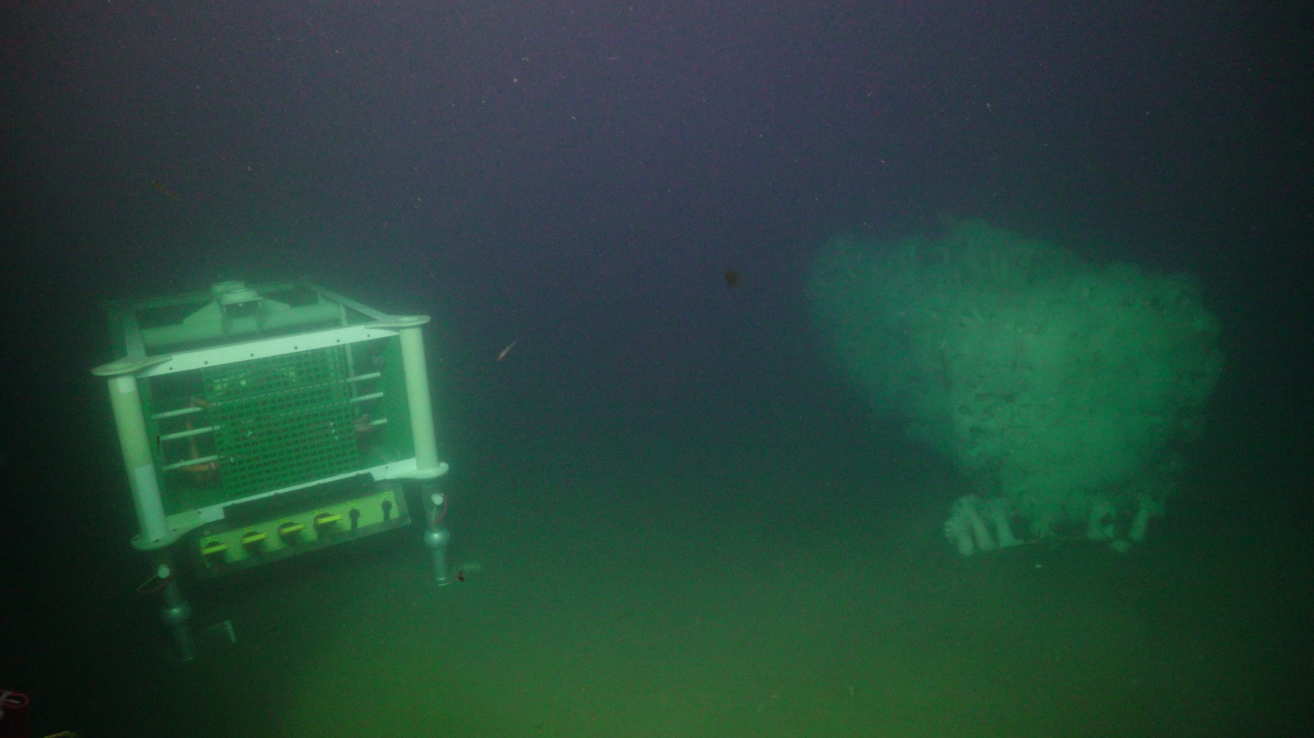
Secondary Node LV01A at Slope Base (2900 m), deployed since 2014 and ready for recovery. Credit: UW/NSF-OOI/WHOI, V21

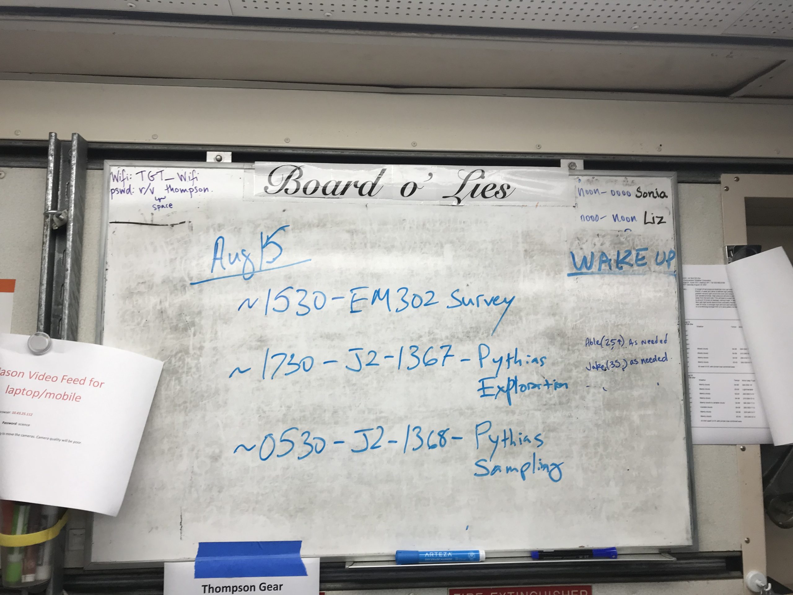
The Board o' Lies for 15 Aug on Leg 2 of VISIONS'21

Screen Shot 2021-08-12 at 3.18.15 PM

PN1B onboard the Integrity with backbone cables attached. Credit: C. McGuire, University of Washington, V12.

Node in transport_image_from_ios

Primary Node PN1B almost on deck of the IT. Integrity. Credit: C. McGuire, University of Washington, V21.

Node almost landed image_from_ios

The Science Interface Assembly removed from Primary Node PN1B and brought onboard the R/V Thompson, latched to the underbelly of Jason. Credit: M. Elend, University of Washington, V21.

J1342_20210805_074156_recovery copy 2

Orest Kawaka displays his stunning survival suit first day of Leg 2. Credit: M. Elend, University of Washington, V21.

Primary Node PN1B in the RCA Logistics Facility at Sandpoint, ready for transport to Newport for loading onto the I.T Integrity Cable Ship. Credit: L. Nielson, University of Washington, V21.

Primary Node PN1B is on its' way to Newport for loading onto the I.T Integrity Cable Ship. Credit: L. Nielson, University of Washington, V21.

The Jason manipulators work with a westmate connector during Leg 2. Credit: E. Littell, University of Washington, V21.

Elise's sketch of the student's work area in the Main Lab of the R/V Thompson. Credit: E. Littell, University of Washington, V21.
- Anemone
- Animal
- Arthropod
- ASHES
- Axial
- Axial Base
- Axial Biology
- Axial Caldera
- Bacteria
- Basalt Lava
- BEP
- Biofouling
- biolgoy
- Biology
- Camds
- Camera
- Camhd
- Central Caldera
- Ciliates
- Cnidaria
- Coastal Biology
- Crab
- Deep Profiler Mooring
- Dive Highlights
- Eastern Caldera
- Echinoderms
- Endurance Array
- Engineering Team
- ENLIGHTEN 10
- Exploratorium
- Fish
- Geology
- HD Camera
- HPIES
- Hydrate Ridge
- Hydrates
- Hydrophone
- Hydrothermal Vents
- Illustration
- Inshore 80 Meters
- Instrument
- International District
- J-BOX
- Jason
- Jellyfish
- Junction Box
- K12
- Lava
- Mollusk
- Moorings
- Nodes
- Nudibranch
- Octopus
- OOI
- Oregon Offshore
- Oregon Offshore 600 m
- Oregon Shelf
- Oregon Slope Base
- People
- PN1B
- PN1D
- Polychaetes
- PPSDN
- Primary Node
- RASFL
- ROCLS
- ROPOS
- ROPOS Dives
- ROV Team
- RV Revelle
- RV Sikuliaq
- RV Thompson
- Salp
- Sample
- SC13
- Science Team
- Sea Cucumber
- Sea Star
- Sea Urchin
- Seafloor
- Seismometer
- Sensors
- Shallow Profiler Mooring
- Shark
- Shipboard
- Shore Station
- Slope Base
- Smoker
- Soft Coral
- Southern Hydrate Ridge
- Sponge
- Squid
- Students
- Students & Guest Participants
- Tmpsf
- Tubeworms
- VISIONS 11 Leg 1
- VISIONS 11 Leg 2
- VISIONS 11 Viewers
- VISIONS 13
- VISIONS 14
- VISIONS 15
- VISIONS 16
- VISIONS 17
- VISIONS 18
- VISIONS 20
- VISIONS 22
- VISIONS 23
- Visualization
