Image Archive












JMW Turner

Students on VISIONS 14 Leg 1 discuss one of the readings on the bow of the Thompson. Photo credit: Leslie Sautter, College of Charleston, V14.

The Conductivity, Temperature and Depth (CTD) probe lies within a large carousel of Niskin water bottles. The carousel is lowered to the seafloor while the CTD makes measurements. On the 'ride' up, a person on deck triggers the water bottles to close (one at a time) to collect a water sample at different depths. Photo credit: Mitch Elend, University of Washinton, V14.

An octopus swims above a rubbly lava flow 5000 ft beneath the ocean's surface at the summit of Axial Seamount. Credit: UW/NSF-OOI/CSSF; ROPOS Dive 1712; V14.

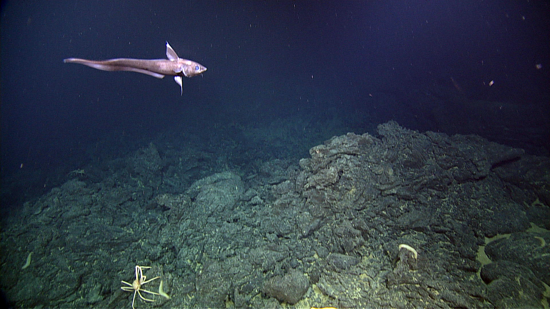
A Pacific Flatnose swims above a sheet flow (lava) on the summit of Axial Seamount. UW/NSF-OOI/CSSF; ROPOS Dive R1712; V14.

A beautiful sea urchin sits on a young lava flow at the summit of Axial Seamount. Photo Credit: NSF-OOI/UW/CSSF; Dive R1712; V14.

Katsushika Hosakai

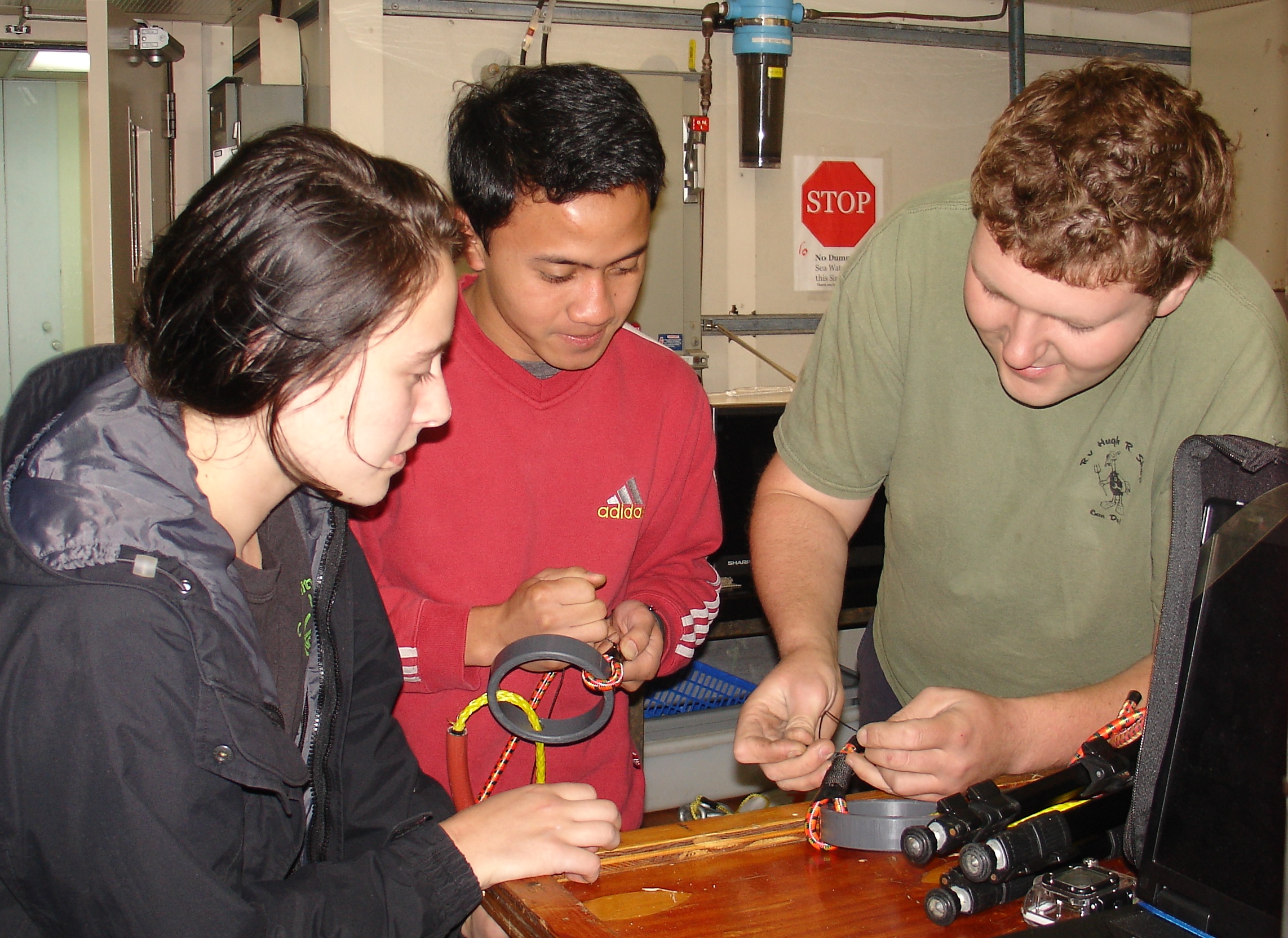
Ben Brand (Univ. of Washington) teaches UW students Don Setiawan and Krista Nunnally to prepare the bungie cords used to tie down the spooled cable's end to the outer part of the ROCLS frame. O-rings provide an easy grab for the ROV's manipulator arm. Photo credit: Leslie Sautter, College of Charleston, V14.

University of Washington, School of Oceanography students watch the first CTD operation on the R/V Thompson. Here, they learn how to safely handle lines, sample ocean water, and conduct analyes onboard once the CTD returns to the deck. Photo Credit: Mitch Elend, University of Washington, V14.

A temperature-resistivity instrument (analogue for chlorinity) is ready for installation in the International Vent Field at Axial Seamount during Leg 1 of the VISIONS'14 expedition. Photo Credit: Don Setiawan, University of Washington, V14.

A broadband seismometer and hydrophone are rigged for installation at the summit of Axial Seamount during VISIONS'14. University of Washington, V14.

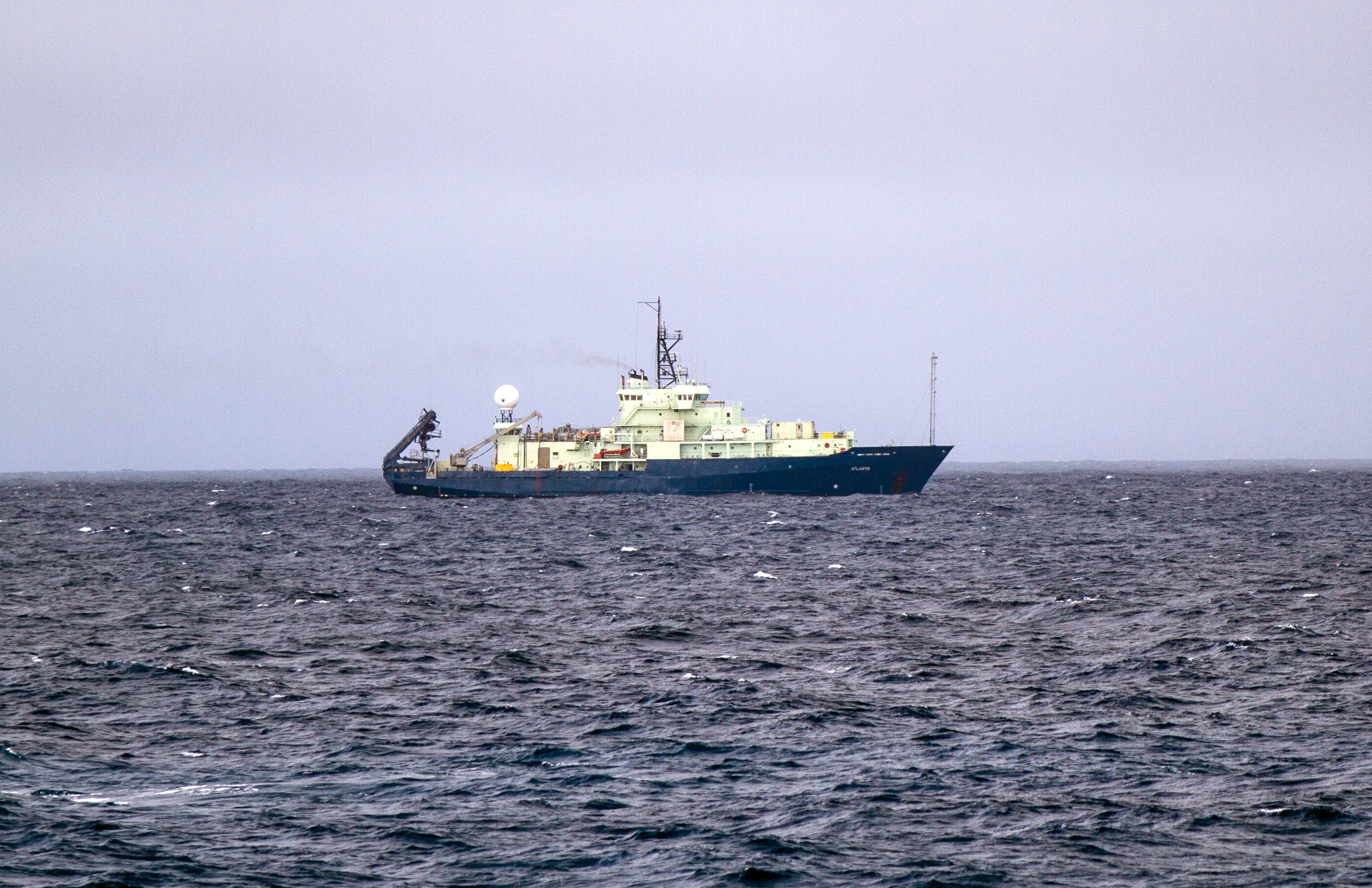
Our sister ship, the R/V Atlantis, working 1.5- to 3-km away from us at the summit of Axia Seamount during the first week of VISIONS'14. The Atlantis effort is focusing on the ASHES hydrothermal field, where we installed an underwater high-definition camera and 3D temperature array last year. Photo Credit: Ed McNichol, Mumbian Enterprises, Inc., V14

This beautiful image of global weather conditions is a screen shot from the http://earth.nullschool.net site. The green circle shows the approximate location of Axial Seamount. Over July 15-16, the wind shifted from westerly to northerly and increased from ~12-16 kts to 22-27 kts . Wind waves increased from ~3’ to 5-6’ during that time. The forecast is for the wind to remain sustained from 25-30 kts from the north and wind waves from 2-3m (6-10’) until Friday morning, when the wind should both shift direction and drop to ~10 kts.

Disney Motion Picture Poster

Thung Chai Picture

1970

Painting

By Pierre Denys de Montfort

Gina looks out toward the control room wall of monitors, watching ROPOS work near the seafloor.

Krista Nunnnally, Gina Hansen, and Don Setiawan watch ROPOS operations in the ROPOS control room during Dive R1712. Photo Credit: Mitch Elend, University of Washington, V14.

Katie Bigham on the R/V Thompson awaiting the ship's departure from Pier 90 in Seattle. Photo Credit: Mitch Elend, University of Washington, V14.

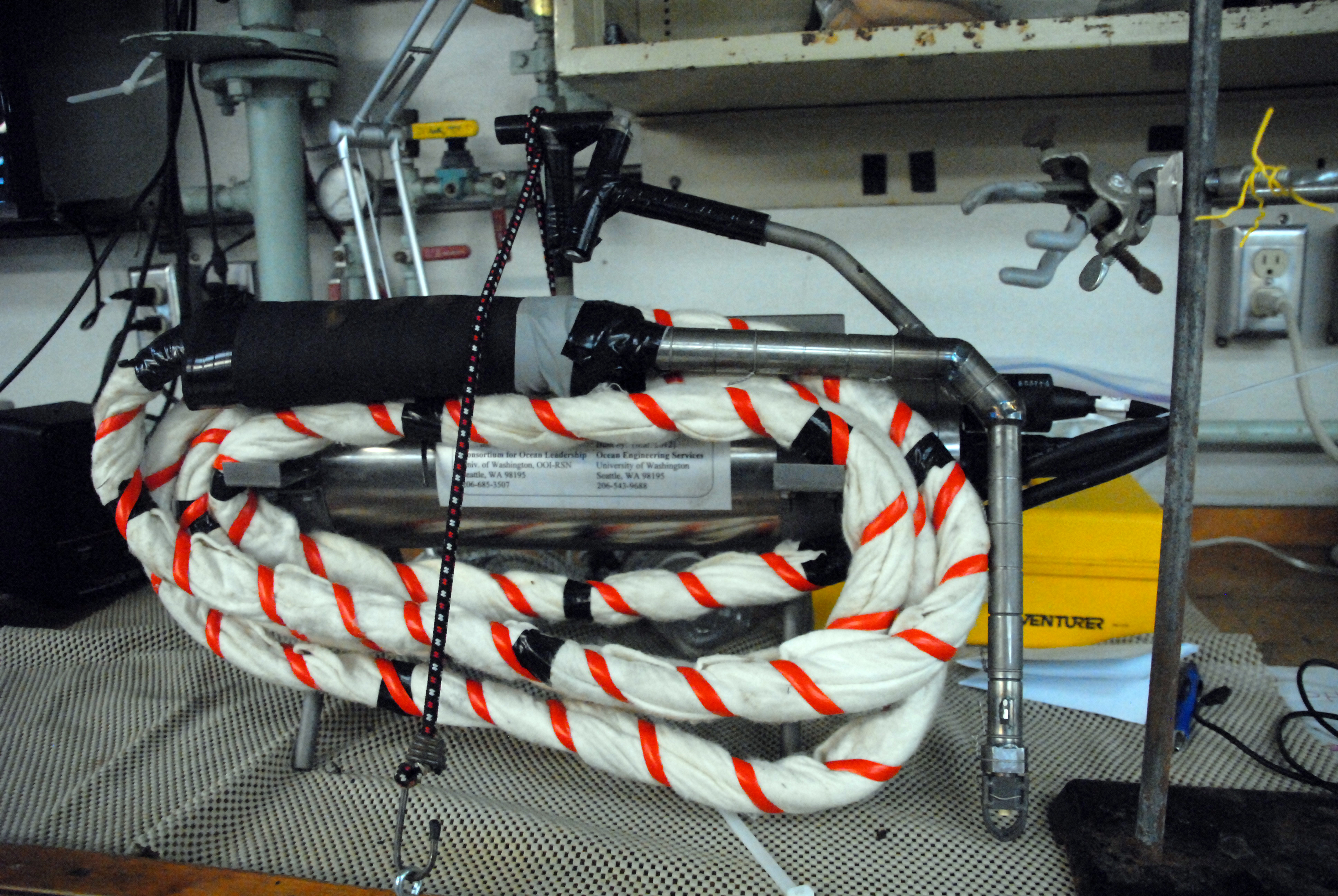
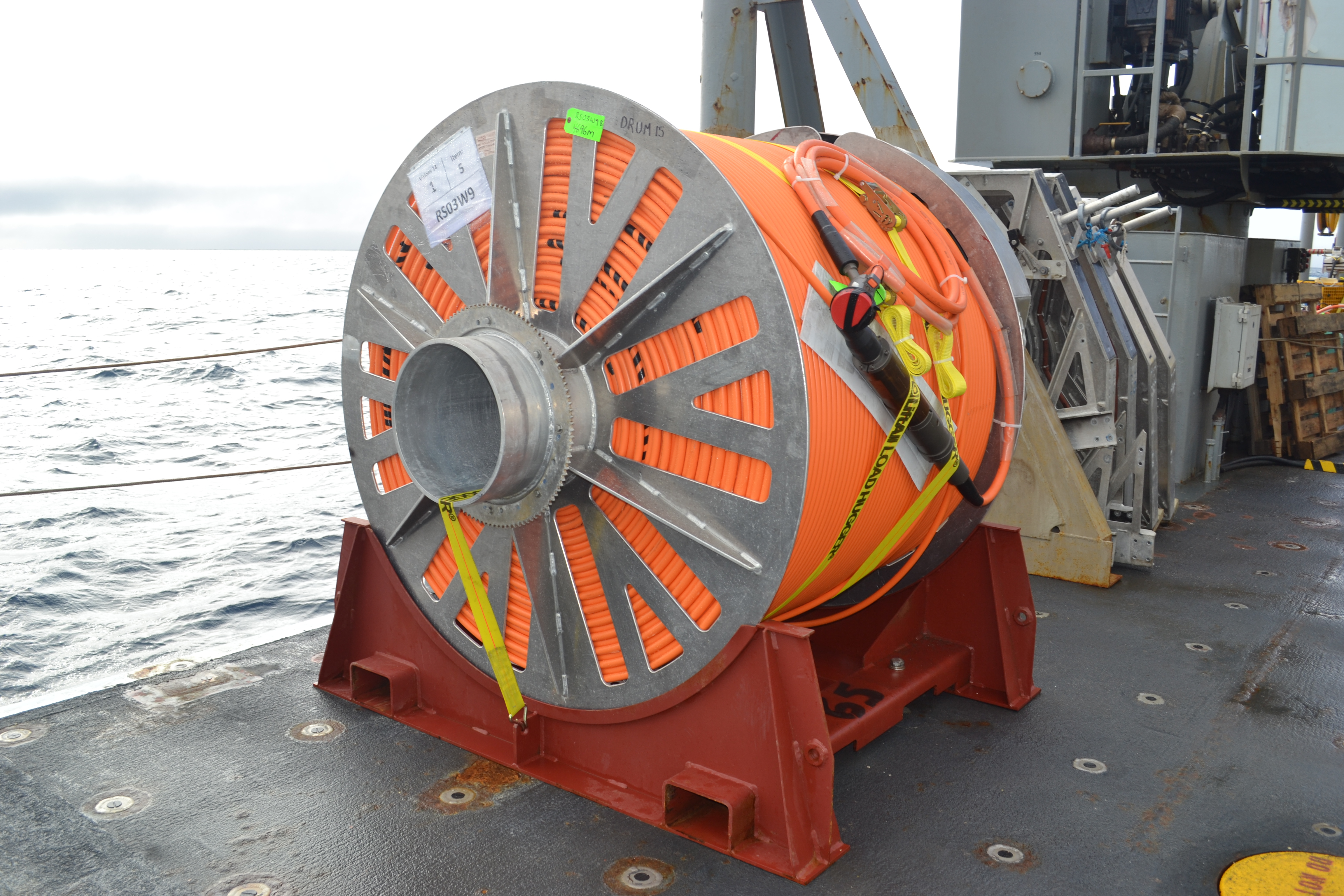
An extension cable, nearly 5 km-long awaits installation at the summit of Axial Seamount. This cable will extend from Primary Node PN3B to the Central Caldera site where it will connect to a medium power junction box hosting a broadband seismometer, hydrophone, and bottom pressure tilt meter.

A Field-Assembled Cable Termination (FACT) on front porch of ROPOS subsequent to cutting the cable. Photo Credit: NSF-OOI/UW/CSSF; Dive R1712; V14

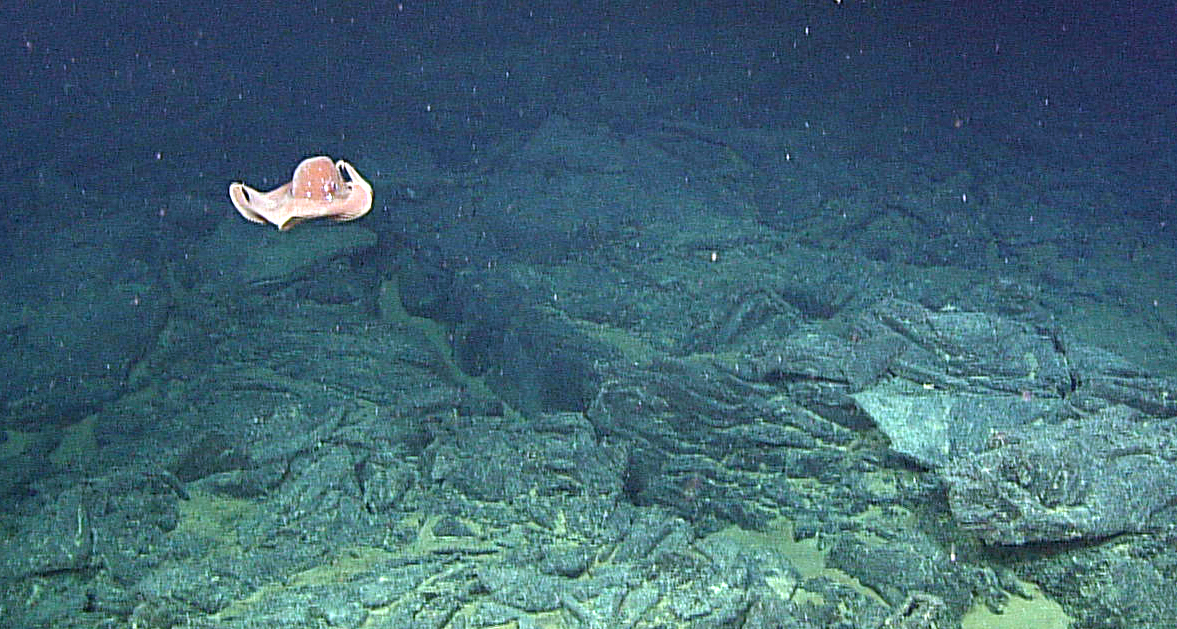
A red jellyfish swims 5000 ft beneath the ocean's surface at Axial Seamount on the Juan de Fuca Ridge. Here, most animals swim slowly to conserve energy in the nearly freezing seawater. Photo credit: NSF-OOI/UW/CSSF; Dive R1712; V14.

The remotely operated vehicle (ROV) ROPOS begins its first science dive at Axial Seamount of VISIONS'14. An empty junction box is attached beneath the ROV's 'belly'. Photo Credit: Mitch Elend, University of Washington, V14.

An assemblage of animals (a rattail fish, spider crabs and holothurians) forage at 5000 ft beneath the ocean's surface at the summit of Axial Seamount. Here, hackly lavas make for rough going for animals. Credit: UW/NSF-OOI/CSSF; ROPOS Dive R1712; V14.

With the ship's heave, pitch and roll, navigating stairwells is a challenge. Photo credit: Charles Garcia, University of Washington, V14.

The first sunset of VISIONS '14 Leg 1 on the Strait of Juan de Fuca was one to remember. Photo credit: Christina Ramirez, University of Washington, V14.
- Anemone
- Animal
- Arthropod
- ASHES
- Axial
- Axial Base
- Axial Biology
- Axial Caldera
- Bacteria
- Basalt Lava
- BEP
- Biofouling
- biolgoy
- Biology
- Camds
- Camera
- Camhd
- Central Caldera
- Ciliates
- Cnidaria
- Coastal Biology
- Crab
- Deep Profiler Mooring
- Dive Highlights
- Eastern Caldera
- Echinoderms
- Endurance Array
- Engineering Team
- ENLIGHTEN 10
- Exploratorium
- Fish
- Geology
- HD Camera
- HPIES
- Hydrate Ridge
- Hydrates
- Hydrophone
- Hydrothermal Vents
- Illustration
- Inshore 80 Meters
- Instrument
- International District
- J-BOX
- Jason
- Jellyfish
- Junction Box
- K12
- Lava
- Mollusk
- Moorings
- Nodes
- Nudibranch
- Octopus
- OOI
- Oregon Offshore
- Oregon Offshore 600 m
- Oregon Shelf
- Oregon Slope Base
- People
- PN1B
- PN1D
- Polychaetes
- PPSDN
- Primary Node
- RASFL
- ROCLS
- ROPOS
- ROPOS Dives
- ROV Team
- RV Revelle
- RV Sikuliaq
- RV Thompson
- Salp
- Sample
- SC13
- Science Team
- Sea Cucumber
- Sea Star
- Sea Urchin
- Seafloor
- Seismometer
- Sensors
- Shallow Profiler Mooring
- Shark
- Shipboard
- Shore Station
- Slope Base
- Smoker
- Soft Coral
- Southern Hydrate Ridge
- Sponge
- Squid
- Students
- Students & Guest Participants
- Tmpsf
- Tubeworms
- VISIONS 11 Leg 1
- VISIONS 11 Leg 2
- VISIONS 11 Viewers
- VISIONS 13
- VISIONS 14
- VISIONS 15
- VISIONS 16
- VISIONS 17
- VISIONS 18
- VISIONS 20
- VISIONS 22
- VISIONS 23
- Visualization
